Emtel Data Center Arsenal
Emtel Data Center Arsenal is a building in Pamplemousses, Mauritius. Emtel Data Center Arsenal is situated nearby to the town Baie du Tombeau, as well as near the suburb Sainte-Croix.| Tap on a place to explore it |
Places of Interest Nearby
Highlights include Sir Seewoosagur Ramgoolam Botanical Garden and L’Aventure du Sucre.
Sir Seewoosagur Ramgoolam Botanical Garden
Garden

Photo: Lonelyplanet, CC BY-SA 3.0 de.
The Sir Seewoosagur Ramgoolam Botanic Garden, commonly known as the Pamplemousses Botanic Garden, is a popular tourist attraction in Pamplemousses, near Port Louis, Mauritius, and the oldest botanical garden in the Southern Hemisphere. Sir Seewoosagur Ramgoolam Botanical Garden is situated 4 km east of Emtel Data Center Arsenal.
L’Aventure du Sucre
Museum

Photo: Wikimedia, CC BY-SA 4.0.
L’Aventure du Sucre is a museum, which is situated 3½ km east of Emtel Data Center Arsenal.
Pamplemousses Cemetery
Cemetery
 Pamplemousses Cemetery is situated 3½ km east of Emtel Data Center Arsenal.
Places in the Area
Nearby places include Baie du Tombeau and Triolet.
Baie du Tombeau
Town
Baie du Tombeau is a village in Mauritius located in the Pamplemousses District, situated near the Rivière du Tombeau. The village is administered by the Baie du Tombeau Village Council under the aegis of the Pamplemousses District Council. Baie du Tombeau is situated 5 km west of Emtel Data Center Arsenal.
Triolet
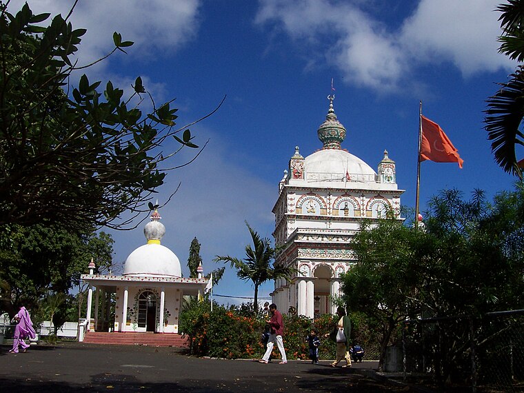
Photo: Toutaitanous 2, CC BY-SA 3.0.
Triolet is a medium-sized town in the north of the Mauritius district of Pamplemousses. It lies exactly 11 kilometres from Port Louis, the capital of the island.
Sainte-Croix
Suburb

Photo: Sblaval, CC BY-SA 2.5.
Sainte-Croix is a suburb of the capital city, Port Louis, in Mauritius, an independent island in the Indian Ocean. It is most famous for its association with the Roman Catholic beatus Jacques-Désiré Laval, who worked in Sainte-Croix as a missionary from 1841 until his death in 1864. Sainte-Croix is situated 5 km south of Emtel Data Center Arsenal.
Emtel Data Center Arsenal
- Type: Building
- Location: Pamplemousses, Mauritius, East African Islands, Africa
- View on OpenStreetMap
Latitude
-20.10365° or 20° 6′ 13″ southLongitude
57.54327° or 57° 32′ 36″ eastOperator
EmtelOpen location code
5HFVVGWV+G8OpenStreetMap ID
way 746248943OpenStreetMap feature
building=yes
This page is based on OpenStreetMap, Wikidata, and Wikimedia Commons.
We’d love your help improving our open data sources. Thank you for contributing.
Satellite Map
Discover Emtel Data Center Arsenal from above in high-definition satellite imagery.
Notable Places Nearby
Highlights include Sir Seewoosagur Ramgoolam Medical College and Sir Seewoosagur Ramgoolam Medical College.
Nearby Places
Explore places such as Alla Moda Shoes and VIVERE COLLECTIONS LTD WAREHOUSE.
Mauritius: Must-Visit Destinations
Delve into Port Louis, Rodrigues, Le Morne Brabant, and Curepipe.
Curious Buildings to Discover
Uncover intriguing buildings from every corner of the globe.
About Mapcarta. Data © OpenStreetMap contributors and available under the Open Database License". Text is available under the CC BY-SA 4.0 license, except for photos, directions, and the map. Photo: Simisa, CC BY-SA 3.0.