Kingsland
Kingsland is a residential area in Eastbourne District, East Sussex, England which is located on Granville Road. Kingsland is situated nearby to Church of All Saints, as well as near Grange Gardens.| Tap on a place to explore it |
Places of Interest Nearby
Highlights include Church of All Saints and Our Lady of Ransom Church, Eastbourne.
Church of All Saints
Church

Photo: Hassocks5489, CC0.
Church of All Saints is situated 1,100 feet east of Kingsland.
Our Lady of Ransom Church, Eastbourne
Church

Photo: The Voice of Hassocks, CC0.
Our Lady of Ransom Church is a Roman Catholic Parish church in Eastbourne, East Sussex. It was founded as a mission in 1869, built from 1900 to 1903, and had extensions completed in 1926. Our Lady of Ransom Church, Eastbourne is situated 1,600 feet northeast of Kingsland.
Eastbourne Town Hall
Town hall

Photo: Paul the Archivist, CC BY-SA 4.0.
Eastbourne Town Hall is a municipal building in Grove Road, Eastbourne, East Sussex, England. The town hall, which is the meeting place of Eastbourne Borough Council, is a Grade II listed building. Eastbourne Town Hall is situated 1,800 feet north of Kingsland.
Places in the Area
Nearby places include Eastbourne and Friston.
Eastbourne

Photo: Diliff, CC BY-SA 3.0.
Eastbourne is a popular and traditional sea-side resort town in East Sussex, on England's South East coast. It has one of the highest recorded days of sunshine per year in Britain and its climate is notable for its relatively high sunshine levels, with the town claiming to be the "Sunniest Place in the UK".
Friston
Village
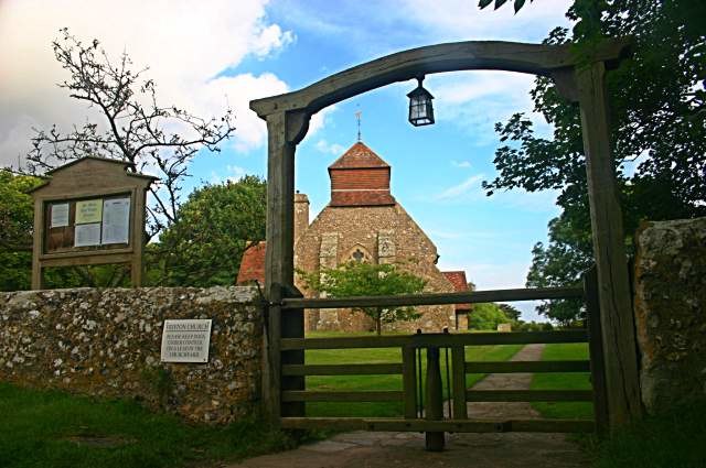
Photo: Toby Speight, CC BY-SA 2.0.
Friston is a village, which is situated 3 miles west of Kingsland.
Westdean
Village

Photo: Ian Cunliffe, CC BY-SA 2.0.
Westdean is a village, which is situated 5 miles west of Kingsland.
Kingsland
- Type: Residential area
- Address: Granville Road, Eastbourne, BN20 7HH
- Location: Eastbourne District, East Sussex, South East England, England, United Kingdom, Britain and Ireland, Europe
- View on OpenStreetMap
Latitude
50.76204° or 50° 45′ 43″ northLongitude
0.27493° or 0° 16′ 30″ eastLevels
5Height
66 feet (20 metres)Open location code
9F22Q76F+RXOpenStreetMap ID
way 746410050OpenStreetMap feature
landuse=residential
This page is based on OpenStreetMap, Wikidata, and Wikimedia Commons.
We’d love your help improving our open data sources. Thank you for contributing.
Satellite Map
Discover Kingsland from above in high-definition satellite imagery.
Places with the Same Name
Discover other places named “Kingsland”.
Notable Places Nearby
Highlights include Grange Gardens and Compton Place.
Nearby Places
Explore places such as Chelmsford Court and Merlswood.
East Sussex: Must-Visit Destinations
Delve into Brighton, Eastbourne, Hastings, and Lewes.
Curious Residential Areas to Discover
Uncover intriguing residential areas from every corner of the globe.
About Mapcarta. Data © OpenStreetMap contributors and available under the Open Database License". Text is available under the CC BY-SA 4.0 license, except for photos, directions, and the map. Photo: matthewhartley369, CC BY-SA 2.0.