Heathery Edge
Heathery Edge is a residential area in Bywell, Northumberland, England. Heathery Edge is situated nearby to Church of St James, as well as near the motorhome stopover Wellhouse Farm Caravan Park.| Tap on a place to explore it |
Places of Interest Nearby
Highlights include Church of St James and Mowden Hall School.
Church of St James
Church

Photo: Mike Quinn, CC BY-SA 2.0.
Church of St James is situated 2,700 feet south of Heathery Edge.
Mowden Hall School
School
Mowden Hall School is a co-educational and boarding preparatory school in the parish of Bywell, in Stocksfield, Northumberland, England, approximately 11 miles west of Newcastle upon Tyne. Mowden Hall School is situated 4,000 feet southeast of Heathery Edge.
Aydon Castle
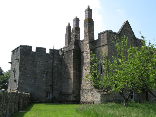
Photo: Wikimedia, CC BY-SA 2.0.
Aydon Castle, previously sometimes called Aydon Hall, is a fortified manor house at Aydon near to the town of Corbridge, Northumberland, England. It is a Scheduled Ancient Monument, and is designated by English Heritage as a Grade I listed building. Aydon Castle is situated 2 miles west of Heathery Edge.
Places in the Area
Nearby places include Newton and Aydon.
Newton
Village

Photo: Mike Quinn, CC BY-SA 2.0.
Newton is a village and former civil parish, now the parish of Bywell, in Northumberland, England. It is situated close to the A69 road, 3 miles north of Stocksfield and 13 miles west of Newcastle upon Tyne.
Aydon
Hamlet
Photo: Wikimedia, CC BY-SA 2.0.
Aydon is a village and former civil parish, now in the parish of Corbridge, in Northumberland, England. It is about 2 miles northeast of Corbridge on the B6321 road. Aydon is situated 1½ miles west of Heathery Edge.
Halton
Hamlet

Photo: Mike Quinn, CC BY-SA 2.0.
Halton is a village and former civil parish, now in the parish of Whittington, in the southern part of Northumberland, England. It is situated 3 miles north of Corbridge just south of Hadrian's Wall. Halton is situated 2½ miles northwest of Heathery Edge.
Heathery Edge
Latitude
54.98905° or 54° 59′ 21″ northLongitude
-1.94586° or 1° 56′ 45″ westOpen location code
9C6WX3Q3+JMOpenStreetMap ID
way 749175539OpenStreetMap feature
landuse=residential
This page is based on OpenStreetMap, Wikidata, and Wikimedia Commons.
We’d love your help improving our open data sources. Thank you for contributing.
Satellite Map
Discover Heathery Edge from above in high-definition satellite imagery.
Notable Places Nearby
Highlights include Wellhouse Farm Caravan Park and Shildonhill Plantation.
Nearby Places
Explore places such as Newton Fell House and Television Mast.
Northumberland: Must-Visit Destinations
Delve into Berwick-upon-Tweed, Lindisfarne, Alnwick, and Morpeth.
Curious Residential Areas to Discover
Uncover intriguing residential areas from every corner of the globe.
About Mapcarta. Data © OpenStreetMap contributors and available under the Open Database License". Text is available under the CC BY-SA 4.0 license, except for photos, directions, and the map. Photo: matthewhartley369, CC BY-SA 2.0.