Taman Bukit Payong Utama
Taman Bukit Payong Utama is a residential area in Marang, Terengganu. Taman Bukit Payong Utama is situated nearby to the police station Balai Polis Bukit Payong, as well as near the recreation area Dataran Bukit Payong.| Tap on a place to explore it |
Places in the Area
Nearby places include Bukit Payong and Padang Midin.
Bukit Payong
Town
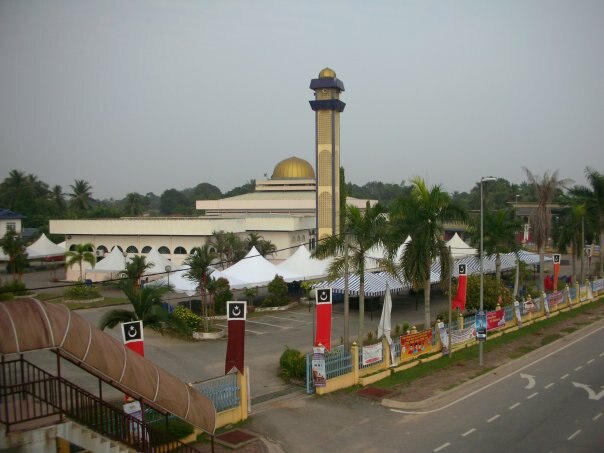
Photo: Masrichenko, CC BY-SA 3.0.
Bukit Payong is a town Marang District, Terengganu, Malaysia. The population comprises 95.85% Malays, 4% Chinese and 0.15% of other races. The town borders with the district of Kuala Terengganu.
Padang Midin
Village
Padang Midin is a small village in Kuala Terengganu District, Terengganu, Malaysia. Padang Midin is situated 3½ km north of Taman Bukit Payong Utama.
Kampung Tok Imam Lapar
Village
Kampung Tok Imam Lapar is a small village in Hulu Terengganu region, Terengganu, Malaysia. The village is located close to the western banks of the Terengganu River. Kampung Tok Imam Lapar is situated 9 km west of Taman Bukit Payong Utama.
Taman Bukit Payong Utama
- Type: Residential area
- Location: Marang, Terengganu, East Coast, Malaysia, Southeast Asia, Asia
- View on OpenStreetMap
Latitude
5.22983° or 5° 13′ 47″ northLongitude
103.10172° or 103° 6′ 6″ eastOpen location code
6PQ564H2+WMOpenStreetMap ID
way 759380915OpenStreetMap feature
landuse=residential
This page is based on OpenStreetMap, Wikidata, and Wikimedia Commons.
We’d love your help improving our open data sources. Thank you for contributing.
Satellite Map
Discover Taman Bukit Payong Utama from above in high-definition satellite imagery.
Notable Places Nearby
Highlights include Balai Polis Bukit Payong and Dataran Bukit Payong.
Nearby Places
Explore places such as Pustaka Seri Intan and MR.DIY.
Terengganu: Must-Visit Destinations
Delve into Perhentian Islands, Kuala Terengganu, Pulau Redang, and Kapas.
Curious Residential Areas to Discover
Uncover intriguing residential areas from every corner of the globe.
About Mapcarta. Data © OpenStreetMap contributors and available under the Open Database License". Text is available under the CC BY-SA 4.0 license, except for photos, directions, and the map. Photo: Wikimedia, CC0.