Bhuj Sector 280
Bhuj Sector 280 is in Bhuj, Kutch, Gujarat. Bhuj Sector 280 is situated nearby to the peak Bhujiyo Hill, as well as near the village Madhapar.| Tap on a place to explore it |
Places of Interest Nearby
Highlights include Bhujia Hill and Bhuj railway station.
Bhujia Hill

Photo: Nizil Shah, CC BY-SA 3.0.
Bhujia Hill or Bhujiyo Dungar is a hill located in the outskirts of the town of Bhuj in the district of Kutch, Gujarat, India. The Bhujia Fort built on the hill overlooks the town. Bhujia Hill is situated 1½ km south of Bhuj Sector 280.
Bhuj railway station
Railway station
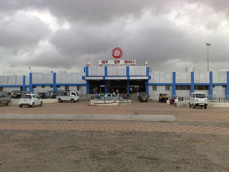
Photo: Superfast1111, CC BY-SA 3.0.
Bhuj railway station is a Class-A railway station in Bhuj, Gujarat, India, on the Western line of the Western Railway network. It is the last station on the Western Railway line in the area. It handles nine trains. Bhuj railway station is situated 2 km northwest of Bhuj Sector 280.
Hamirsar Lake
Lake

Photo: Nizil Shah, CC BY-SA 3.0.
Hamirsar Lake is a man-made lake situated in the centre of Bhuj, the headquarters of Kutch district in the Indian state of Gujarat. Hamirsar Lake is situated 3 km west of Bhuj Sector 280.
Places in the Area
Nearby places include Madhapar and Bhuj.
Madhapar
Village

Photo: Vijay8808, CC BY-SA 4.0.
Madhapar is a village located in Kachchh district in the state of Gujarat, India. It is the richest village in India in terms of bank deposits. The village has around 20,000 households and 70,000,000,000 Indian rupee of bank deposits.
Bhuj

Photo: calliopejen, CC BY-SA 2.0.
Bhuj is a city and the headquarters of Kutch district in the Indian state of Gujarat. It was the capital of Cutch State, which was a princely state before it was merged into the Indian Union in 1947.
Nagor
Village
Nagor is a village in Bhuj Taluka of Kutch at a distance of about 8 km from Bhuj town, the capital of Kachchh District of Gujarat in India. Nagor is situated 8 km northeast of Bhuj Sector 280.
Bhuj Sector 280
- Type: Industry
- Location: Bhuj, Kutch, Gujarat, Western India, India, South Asia, Asia
- View on OpenStreetMap
Latitude
23.25777° or 23° 15′ 28″ northLongitude
69.69347° or 69° 41′ 37″ eastOpen location code
7JMF7M5V+49OpenStreetMap ID
way 768640538OpenStreetMap feature
landuse=industrial
This page is based on OpenStreetMap, Wikidata, and Wikimedia Commons.
We’d love your help improving our open data sources. Thank you for contributing.
Satellite Map
Discover Bhuj Sector 280 from above in high-definition satellite imagery.
Notable Places Nearby
Highlights include Mahadev Temple and Dsalsar Lake.
Nearby Places
Explore places such as Bhuj Sector 281 and Bhuj Sector 272.
Kutch: Must-Visit Destinations
Delve into Bhuj, Dholavira, Gandhidham, and Mandvi.
Curious Places to Discover
Uncover intriguing places from every corner of the globe.
About Mapcarta. Data © OpenStreetMap contributors and available under the Open Database License". Text is available under the CC BY-SA 4.0 license, except for photos, directions, and the map. Photo: Chinmayisk, CC BY-SA 3.0.