High Street Youth Health Service
High Street Youth Health Service is a clinic in Parramatta, Sydney, New South Wales which is located on High Street. High Street Youth Health Service is situated nearby to Western Sydney College, as well as near Harris Park Station Concourse.| Tap on a place to explore it |
Places of Interest Nearby
Highlights include Harris Park railway station and Parramatta railway station.
Harris Park railway station
Railway station
 Harris Park railway station is located on the Main Western line, serving the Sydney suburb of Harris Park. It is served by Sydney Trains' T1 Western Line, T2 Leppington & Inner West Line and T5 Cumberland Line services. Harris Park railway station is situated 130 metres east of High Street Youth Health Service.
Parramatta railway station
Railway station

Photo: Gareth, CC BY-SA 3.0.
Parramatta railway station is a heritage-listed railway station located on the Main Western line, serving Parramatta in New South Wales, Australia. It is served by Sydney Trains' T1 Western Line, T2 Leppington & Inner West and T5 Cumberland Line services and NSW TrainLink Blue Mountains Line, Central West Express and Outback Xplorer services. Parramatta railway station is situated 650 metres north of High Street Youth Health Service.
New South Wales Lancers Memorial Museum
Museum

Photo: Jp-8000, CC BY-SA 4.0.
The New South Wales Lancers Memorial Museum is a military museum at Linden House, 2 Smith Street, Parramatta, Sydney, Australia. The museum's collection is heritage-listed, having been added to the New South Wales State Heritage Register on 14 May 2010. New South Wales Lancers Memorial Museum is situated 680 metres north of High Street Youth Health Service.
Places in the Area
Nearby places include Rydalmere and Dundas.
Rydalmere
Suburb
Rydalmere is a suburb of Sydney, in the state of New South Wales, Australia. Rydalmere is approximately 21 kilometres west of the Sydney central business district in the local government area of the City of Parramatta. Rydalmere is situated 3½ km east of High Street Youth Health Service.
Dundas
Suburb
Dundas is a suburb of Sydney, New South Wales, Australia. Dundas is located 21 kilometres north-west of the Sydney central business district, in the local government area of the City of Parramatta, and the electoral division of Bennelong. Dundas is situated 4 km northeast of High Street Youth Health Service.
Newington
Suburb
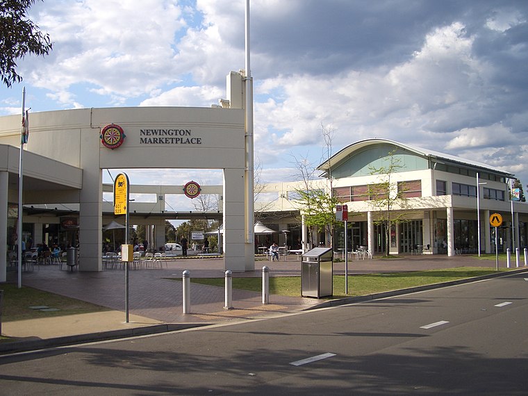 Newington is a western suburb of Sydney, in the state of New South Wales, Australia. It is 16 kilometres west of the Sydney central business district, in the local government area of City of Parramatta. Newington is situated 4½ km east of High Street Youth Health Service.
High Street Youth Health Service
- Type: Clinic
- Address: 65 High Street, Parramatta, NSW 2150
- Categories: health care and building
- Location: Parramatta, Sydney, New South Wales, Australia, Oceania
- View on OpenStreetMap
Latitude
-33.82333° or 33° 49′ 24″ southLongitude
151.00627° or 151° 0′ 23″ eastOpen location code
4RRH52G4+MGOpenStreetMap ID
way 771520295OpenStreetMap feature
amenity=clinicOpenStreetMap feature
building=yesOpenStreetMap feature
healthcare=clinic
This page is based on OpenStreetMap, Wikidata, and Wikimedia Commons.
We’d love your help improving our open data sources. Thank you for contributing.
Satellite Map
Discover High Street Youth Health Service from above in high-definition satellite imagery.
Notable Places Nearby
Highlights include Western Sydney College and Harris Park Station Concourse.
Nearby Places
Explore places such as Highend Lashes - Eyelash Extension Parramatta and Llorels.
Sydney: Must-Visit Destinations
Delve into Eastern suburbs, City Centre, Sydney Harbour National Park, and Inner West.
Curious Clinics to Discover
Uncover intriguing clinics from every corner of the globe.
About Mapcarta. Data © OpenStreetMap contributors and available under the Open Database License". Text is available under the CC BY-SA 4.0 license, except for photos, directions, and the map. Photo: Wikimedia, CC BY-SA 3.0.