Bürgerhaus Hochscheid
Bürgerhaus Hochscheid is a community center in Hochscheid, Bernkastel-Wittlich, Rhineland-Palatinate which is located on Hauptstraße. Bürgerhaus Hochscheid is situated nearby to the fire station Freiwillige Feuerwehr Hochscheid, as well as near Protestant Church.| Tap on a place to explore it |
Places of Interest Nearby
Highlights include Protestant Church and Protestant Church (Hirschfeld Hunsrück).

Protestant Church (Hirschfeld Hunsrück)
Church

Photo: HelgeRieder, CC BY-SA 3.0.
Protestant Church (Hirschfeld Hunsrück) is situated 3 km northeast of Bürgerhaus Hochscheid.
Stumpfer Turm Morbach
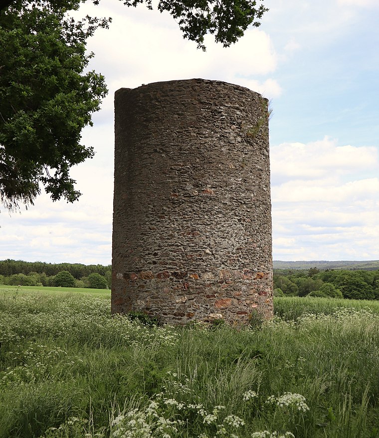
Photo: Palauenc05, CC BY-SA 4.0.
Stumpfer Turm Morbach is situated 4 km southwest of Bürgerhaus Hochscheid.
Places in the Area
Nearby places include Horbruch and Hirschfeld.
Horbruch
Village
 Horbruch is an Ortsgemeinde – a municipality belonging to a Verbandsgemeinde, a kind of collective municipality – in the Birkenfeld district in Rhineland-Palatinate, Germany. It belongs to the Verbandsgemeinde Herrstein-Rhaunen, whose seat is in Herrstein.
Hirschfeld
Village
 Hirschfeld is an Ortsgemeinde – a municipality belonging to a Verbandsgemeinde, a kind of collective municipality – in the Rhein-Hunsrück-Kreis in Rhineland-Palatinate, Germany. Hirschfeld is situated 3 km northeast of Bürgerhaus Hochscheid.
Ilsbach
Hamlet

Photo: Wikimedia, Copyrighted free use.
Ilsbach is a hamlet, which is situated 4 km west of Bürgerhaus Hochscheid.
Bürgerhaus Hochscheid
- Type: Community center
- Address: Hauptstraße 20, Hochscheid, 54472
- Category: building
- Location: Hochscheid, Bernkastel-Wittlich, Rhineland-Palatinate, Germany, Central Europe, Europe
- View on OpenStreetMap
Latitude
49.8749° or 49° 52′ 30″ northLongitude
7.2179° or 7° 13′ 4″ eastOpen location code
8FX9V6F9+X5OpenStreetMap ID
way 777260994OpenStreetMap feature
amenity=community_centreOpenStreetMap feature
building=yes
This page is based on OpenStreetMap, Wikidata, and Wikimedia Commons.
We’d love your help improving our open data sources. Thank you for contributing.
Satellite Map
Discover Bürgerhaus Hochscheid from above in high-definition satellite imagery.
Notable Places Nearby
Highlights include Freiwillige Feuerwehr Hochscheid and Freiwillige Feuerwehr Horbruch-Krummenau.
Nearby Places
Explore places such as Römerstube and Auto Boos.
Rhineland-Palatinate: Must-Visit Destinations
Delve into Mainz, Trier, Koblenz, and Worms.
Curious Community Centers to Discover
Uncover intriguing community centers from every corner of the globe.
About Mapcarta. Data © OpenStreetMap contributors and available under the Open Database License". Text is available under the CC BY-SA 4.0 license, except for photos, directions, and the map. Photo: Traveler100, CC BY-SA 3.0.