Philadelphia Housing Authority Headquarters
Philadelphia Housing Authority Headquarters is a government office in Philadelphia, Philadelphia Region, Pennsylvania. Philadelphia Housing Authority Headquarters is situated nearby to Bethel Church of Christ, as well as near the church Tabernacle of Praise Family.| Tap on a place to explore it |
Places of Interest Nearby
Highlights include Philadelphia Art Museum and McDowell Memorial Presbyterian Church.
Philadelphia Art Museum
Museum
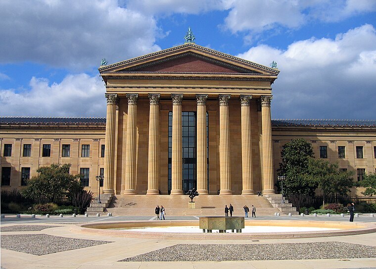
Photo: Wikimedia, Public domain.
The Philadelphia Art Museum, formerly the Philadelphia Museum of Art, is an art museum originally chartered in 1876 for the Centennial Exposition in Philadelphia. Philadelphia Art Museum is situated 1 mile southwest of Philadelphia Housing Authority Headquarters.
McDowell Memorial Presbyterian Church
Church

Photo: Smallbones, CC0.
The McDowell Memorial Presbyterian Church is a historic church in north Philadelphia, built in the Richardson Romanesque style by architects Henry Augustus Sims and J. William Shaw. It was listed on the National Register of Historic Places in September, 2013. McDowell Memorial Presbyterian Church is situated 1,100 feet north of Philadelphia Housing Authority Headquarters.
Church of the Gesú
Church

Photo: Wikimedia, Public domain.
The Church of the Gesú is a Roman Catholic chapel and former parish church located in Philadelphia, Pennsylvania. Founded in 1868 by Burchard Villiger, the church was the center of several Jesuit educational institutions, including St. Joseph's Preparatory School, St. Church of the Gesú is situated 1,500 feet southeast of Philadelphia Housing Authority Headquarters.
Places in the Area
Nearby places include Sharswood and Francisville.
Sharswood
Neighborhood

Photo: Evrik, CC BY-SA 3.0.
Sharswood is a small neighborhood in the North Philadelphia section of the city of Philadelphia, Pennsylvania in the United States. It is located to the east of Brewerytown, north of Girard College, west of Ridge Avenue, east of 24th Street and south of Cecil B.
Francisville
Neighborhood

Photo: Wikimedia, CC BY-SA 3.0.
Francisville is a neighborhood in North Philadelphia, a section of the city of Philadelphia, Pennsylvania, United States. Its boundaries are Fairmount Avenue to the south, Girard Avenue to the north, Broad Street to the east, and Corinthian Avenue to the west.
Brewerytown
Neighborhood

Photo: Smallbones, Public domain.
Brewerytown is a neighborhood in the North Philadelphia section of Philadelphia, Pennsylvania, United States. An unofficial region, Brewerytown runs approximately between the Schuylkill River's eastern bank and 25th Street, bounded by Montgomery Avenue to the north and Parrish Street to the south.
Philadelphia Housing Authority Headquarters
- Type: Government office
- Categories: building, office, and government building
- Location: Philadelphia, Philadelphia, Philadelphia Region, Pennsylvania, Mid-Atlantic, United States, North America
- View on OpenStreetMap
Latitude
39.97679° or 39° 58′ 36″ northLongitude
-75.16877° or 75° 10′ 8″ westLevels
5Open location code
87F6XRGJ+PFOpenStreetMap ID
way 789742744OpenStreetMap feature
building=yesOpenStreetMap feature
office=government
This page is based on OpenStreetMap, Wikidata, and Wikimedia Commons.
We’d love your help improving our open data sources. Thank you for contributing.
Satellite Map
Discover Philadelphia Housing Authority Headquarters from above in high-definition satellite imagery.
Notable Places Nearby
Highlights include Bethel Church of Christ and Tabernacle of Praise Family.
Nearby Places
Explore places such as New Mt. Zion and Ridge & Master.
Philadelphia: Must-Visit Destinations
Delve into Philadelphia International Airport, Old City, West Philadelphia, and Center City West.
Curious Government Offices to Discover
Uncover intriguing government offices from every corner of the globe.
About Mapcarta. Data © OpenStreetMap contributors and available under the Open Database License". Text is available under the CC BY-SA 4.0 license, except for photos, directions, and the map. Photo: Dave Z, CC BY 2.0.