Torkington Wood
Torkington Wood is a forest in Stockport, England. Torkington Wood is situated nearby to the locality Doodfield Farm, as well as near the village Hawk Green.| Tap on a place to explore it |
Places of Interest
Highlights include Rose Hill Marple railway station and Marple railway station.
Rose Hill Marple railway station
Railway station

Photo: Stephen McKay, CC BY-SA 2.0.
Rose Hill Marple is one of two railway stations that serve Marple in the Metropolitan Borough of Stockport, England; the other is Marple railway station.
Marple railway station
Railway station
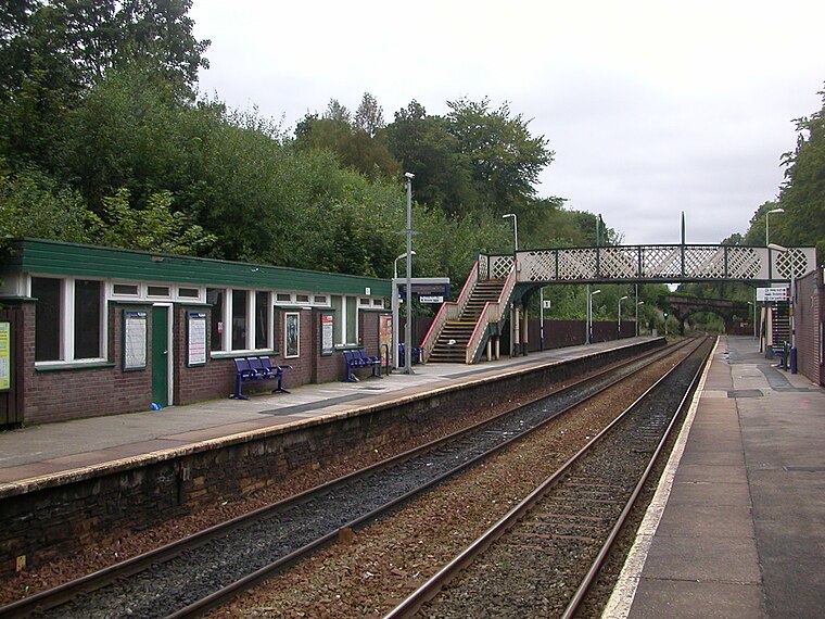
Photo: The Voice of Hassocks, Public domain.
Marple railway station serves the town of Marple, in Greater Manchester, England. It is a stop on the Hope Valley Line, sited 8.9 miles south-east of Manchester Piccadilly.
Hazel Grove railway station
Railway station

Photo: John Attfield, CC BY-SA 2.0.
Hazel Grove railway station serves the village of Hazel Grove, in Greater Manchester, England. It is a junction on both the Stockport to Buxton and Stockport to Sheffield lines.
Places in the Area
Nearby places include Marple and Stockport.
Marple

Photo: Parrot of Doom, Public domain.
Marple is a small town in the borough of Stockport, historically in Cheshire but now part of Greater Manchester. Agatha Christie often travelled this way, and named her character "Miss Marple" after her train was delayed here.
Stockport

Photo: raver mikey, CC BY 2.0.
Stockport is a town in the south east of Greater Manchester, historically in Cheshire, at the point where the rivers Tame and Goyt combine to form the Mersey.
New Mills

Photo: Alan Murray-Rust, CC BY-SA 2.0.
New Mills is in Derbyshire. It's unlikely to feature on many itineraries in its own right, but it's worth stopping off for an hour or two if travelling between Manchester and the Peak District.
Torkington Wood
- Type: Forest
- Location: Stockport, England, United Kingdom, Britain and Ireland, Europe
- View on OpenStreetMap
Latitude
53.3865° or 53° 23′ 11″ northLongitude
-2.0828° or 2° 4′ 58″ westOpen location code
9C5V9WP8+JVOpenStreetMap ID
way 797930931OpenStreetMap feature
natural=wood
This page is based on OpenStreetMap, Wikidata, and Wikimedia Commons.
We’d love your help improving our open data sources. Thank you for contributing.
Satellite Map
Discover Torkington Wood from above in high-definition satellite imagery.
Localities in the Area
Explore places such as Doodfield Farm and Hawk Green.
Notable Places Nearby
Highlights include Marple Wood and Marple RUFC.
England: Must-Visit Destinations
Delve into London, Manchester, Sheffield, and Leeds.
Curious Forests to Discover
Uncover intriguing forests from every corner of the globe.
About Mapcarta. Data © OpenStreetMap contributors and available under the Open Database License". Text is available under the CC BY-SA 4.0 license, except for photos, directions, and the map. Photo: sidibousaid, CC BY 2.0.