St Andrew
St Andrew is a church in Hinton, Stroud District, England. St Andrew is situated nearby to Newtown Post Office, as well as near Sharpness Primary School.| Tap on a place to explore it |
- Type: Church
- Denomination: Anglican
- Description: church in Sharpness, Gloucestershire
Places of Interest Nearby
Highlights include Dr. Jenner’s House and Berkeley Town Hall.
Dr. Jenner’s House
Museum
 Dr. Jenner's House, formerly known as the Edward Jenner Museum, in Berkeley, England, is housed in a grade II* listed early 18th century building called the Chantry, famous as the home of Edward Jenner FRS, physician, surgeon and pioneer of smallpox vaccination, and now used as a museum. Dr. Jenner’s House is situated 1½ miles southeast of St Andrew.
Berkeley Town Hall
Town hall
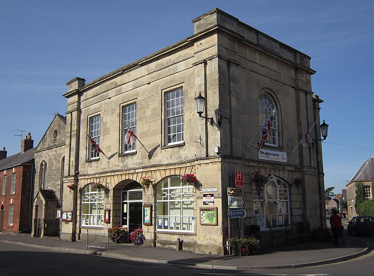
Photo: My another account, CC0.
Berkeley Town Hall is a municipal building in Salter Street, Berkeley, Gloucestershire, England. The structure, which is now used as a community events venue, is a Grade II listed building. Berkeley Town Hall is situated 1½ miles southeast of St Andrew.
Purton Hulks
Disaster remains

Photo: Philip Halling, CC BY-SA 2.0.
The Purton Hulks or Purton Ships' Graveyard is a number of abandoned boats and ships, deliberately beached beside the River Severn near Purton in Gloucestershire, England, to reinforce the river banks. Purton Hulks is situated 1½ miles northeast of St Andrew.
Places in the Area
Nearby places include Sharpness and Vale of Berkeley.
Sharpness
Village

Photo: Steinsky, CC BY-SA 3.0.
Sharpness is a port in the civil parish of Hinton, in the Stroud district, in Gloucestershire, England, one of the most inland in Britain, and eighth largest in the South West England region.
Vale of Berkeley
Locality
The Vale of Berkeley is an area in Gloucestershire, England. It lies between the River Severn and the Cotswold Edge, north of Bristol and south of Gloucester.
Berkeley

Photo: Robin Poitou, CC BY-SA 3.0.
Berkeley is a village in the English county of Gloucestershire. It is perhaps best known as the location of Berkeley Castle, a medieval fortress witness to many of the significant developments in British history, and as the birthplace and home of Edward Jenner, the inventor of inoculation.
St Andrew
- Categories: building, place of worship, and religion
- Location: Hinton, Stroud District, Gloucestershire, West Country, England, United Kingdom, Britain and Ireland, Europe
- View on OpenStreetMap
Latitude
51.71306° or 51° 42′ 47″ northLongitude
-2.47385° or 2° 28′ 26″ westOpen location code
9C3VPG7G+6FOpenStreetMap ID
way 813211013OpenStreetMap feature
amenity=place_of_worshipOpenStreetMap feature
building=churchOpenStreetMap attribute
denomination=anglicanWikidata ID
Q105107101
This page is based on OpenStreetMap, Wikidata, and Wikimedia Commons.
We’d love your help improving our open data sources. Thank you for contributing.
Satellite Map
Discover St Andrew from above in high-definition satellite imagery.
Places with the Same Name
Discover other places named “St Andrew”.
Notable Places Nearby
Highlights include Newtown Post Office and Sharpness Primary School.
Nearby Places
Explore places such as Gloucester Rd and Newtown Sharpness Substation.
Gloucestershire: Must-Visit Destinations
Delve into Gloucester, Cheltenham, Cirencester, and Yate.
Curious Churches to Discover
Uncover intriguing churches from every corner of the globe.
About Mapcarta. Data © OpenStreetMap contributors and available under the Open Database License". Text is available under the CC BY-SA 4.0 license, except for photos, directions, and the map. Photo: Matthew Hartley, CC BY-SA 2.0.