(W)rapper
(W)rapper is an office building in Los Angeles, Southern California, California. (W)rapper is situated nearby to Syd Kronenthal Park, as well as near the community center Syd Kronenthal Recreation Center.| Tap on a place to explore it |
Places of Interest Nearby
Highlights include La Cienega/Jefferson station and Culver City station.
La Cienega/Jefferson station
Railway station

Photo: Wikimedia, CC BY-SA 2.0.
La Cienega/Jefferson station is an elevated light rail station on the E Line of the Los Angeles Metro Rail system. The station is over the intersection of La Cienega Boulevard and Jefferson Boulevard, after which the station is named, in the Baldwin Hills neighborhood of Los Angeles. La Cienega/Jefferson station is situated 1,100 feet east of (W)rapper.
Culver City station
Railway station

Photo: METRO96, CC BY-SA 3.0.
Culver City station is an elevated light rail station on the E Line of the Los Angeles Metro Rail system. The station is located on a dedicated right-of-way alongside Exposition Boulevard — between the intersection of Venice Boulevard and Robertson Boulevard on the west and the intersection of Washington Boulevard and National Boulevard on the east. Culver City station is situated 4,000 feet west of (W)rapper.
Museum of Jurassic Technology
Museum
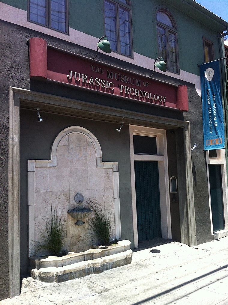
Photo: Tore Danielsson, CC BY-SA 4.0.
The Museum of Jurassic Technology at 9341 Venice Boulevard in the Palms district of Los Angeles, California, was founded by David Hildebrand Wilson and Diana Drake Wilson in 1988. Museum of Jurassic Technology is situated 1 mile west of (W)rapper.
Places in the Area
Nearby places include Reynier Village and Village Green.
Reynier Village
Neighborhood

Photo: Phatblackmama, CC BY-SA 4.0.
Reynier Village is a neighborhood on the Westside of Los Angeles, California. The Reynier Village neighborhood was known as Reynier Park in the 1920s and 1930s although the actual city park was not established until the late 1970s.
Village Green
Neighborhood

Photo: Doncram, CC BY-SA 3.0.
Village Green, originally named Baldwin Hills Village, is a neighborhood at the foot of Baldwin Hills, within the city of Los Angeles, California. Village Green consists of a large condominium complex that is both a Los Angeles Historic-Cultural Monument and a National Historic Landmark.
Baldwin Hills
Quarter

Photo: Los Angeles, CC BY-SA 3.0.
Baldwin Hills is a neighborhood within the south region of Los Angeles, California, United States. Often referred to as the "Black Beverly Hills", Baldwin Hills is home to Kenneth Hahn State Regional Park and Village Green, a National Historic Landmark.
(W)rapper
- Type: Office building
- Categories: building and office
- Location: Los Angeles, Southern California, California, United States, North America
- View on OpenStreetMap
Latitude
34.0264° or 34° 1′ 35″ northLongitude
-118.37569° or 118° 22′ 33″ westInception
2023Levels
16Open location code
85632JGF+HPOpenStreetMap ID
way 813336675OpenStreetMap feature
building=office
This page is based on OpenStreetMap, Wikidata, and Wikimedia Commons.
We’d love your help improving our open data sources. Thank you for contributing.
Satellite Map
Discover (W)rapper from above in high-definition satellite imagery.
Notable Places Nearby
Highlights include Syd Kronenthal Park and Syd Kronenthal Recreation Center.
Nearby Places
Explore places such as TV Liquidator and Baby2Baby.
Los Angeles: Must-Visit Destinations
Delve into Hollywood, San Gabriel Valley, San Fernando Valley, and Long Beach.
Curious Office Buildings to Discover
Uncover intriguing office buildings from every corner of the globe.
About Mapcarta. Data © OpenStreetMap contributors and available under the Open Database License". Text is available under the CC BY-SA 4.0 license, except for photos, directions, and the map. Photo: Mfield, CC BY-SA 3.0.