Hondenspeeltuin Pittelo
Hondenspeeltuin Pittelo is a dog park in Assen, Drenthe. Hondenspeeltuin Pittelo is situated nearby to Recreatiepark Pittelo, as well as near the peak Pittelose berg.| Tap on a place to explore it |
Places of Interest Nearby
Highlights include Vleugels and Drentsche Golf & Country Club.
Vleugels
Work of art

Photo: Ronn, CC BY-SA 3.0.
Vleugels is a work of art, which is situated 460 metres southeast of Hondenspeeltuin Pittelo.
Drentsche Golf & Country Club
Golf course
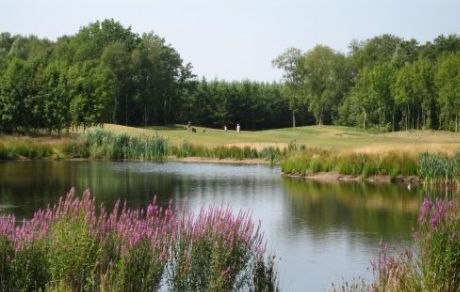
Photo: Pvt pauline, CC BY-SA 3.0.
Drentsche Golf & Country Club is a golf course, which is situated 1¼ km northwest of Hondenspeeltuin Pittelo.
Stadion Marsdijk
Stadium

Photo: Hans055, CC BY-SA 4.0.
Stadion Marsdijk is a stadium, which is situated 2 km east of Hondenspeeltuin Pittelo.
Places in the Area
Nearby places include Ter Aard and Kloosterveen.
Ter Aard
Hamlet

Photo: G. Oosterveen, CC BY-SA 4.0.
Ter Aard is a hamlet in the Netherlands and is part of the Assen municipality in Drenthe. Ter Aard is a statistical entity, and has its own postal code, however it is considered a part of Zeijen.
Kloosterveen
Quarter

Photo: Jeroen loeffen, CC BY-SA 3.0.
Kloosterveen is a quarter, which is situated 3 km southwest of Hondenspeeltuin Pittelo.
Zeijen
Village

Photo: Wikimedia, CC BY-SA 4.0.
Zeijen is a village in the Dutch province of Drenthe. It is a part of the municipality of Tynaarlo. The village was first mentioned in 1370 as Lutbert van Zien, and means "slowly flowing" which is probably a reference to the Matsloot stream. Zeijen is situated 4 km north of Hondenspeeltuin Pittelo.
Hondenspeeltuin Pittelo
- Type: Dog park
- Wheelchair access: yes
- Category: recreation area
- Location: Assen, Drenthe, Northern Netherlands, Netherlands, Benelux, Europe
- View on OpenStreetMap
Latitude
53.01347° or 53° 0′ 49″ northLongitude
6.54815° or 6° 32′ 53″ eastHeight
1.6 metres (5.2 feet)Open location code
9F582G7X+97OpenStreetMap ID
way 816253396OpenStreetMap feature
leisure=dog_parkOpenStreetMap attribute
wheelchair=yes
This page is based on OpenStreetMap, Wikidata, and Wikimedia Commons.
We’d love your help improving our open data sources. Thank you for contributing.
Satellite Map
Discover Hondenspeeltuin Pittelo from above in high-definition satellite imagery.
Notable Places Nearby
Highlights include Recreatiepark Pittelo and Pittelose berg.
Nearby Places
Explore places such as Peelo and Assen, Peelo.
Drenthe: Must-Visit Destinations
Delve into Hoogeveen, Meppel, Coevorden, and Aa en Hunze.
Curious Dog Parks to Discover
Uncover intriguing dog parks from every corner of the globe.
About Mapcarta. Data © OpenStreetMap contributors and available under the Open Database License". Text is available under the CC BY-SA 4.0 license, except for photos, directions, and the map. Photo: Elgaard, CC BY-SA 3.0.