BP
BP is a gas station in Northway, Tewkesbury, England. BP is situated nearby to Ashchurch for Tewkesbury railway station, as well as near Church of St Nicholas.| Tap on a place to explore it |
Places of Interest Nearby
Highlights include Ashchurch for Tewkesbury railway station and Church of St Nicholas.
Ashchurch for Tewkesbury railway station
Railway station

Photo: John Lucas, CC BY-SA 2.0.
Ashchurch for Tewkesbury is a railway station on the main Bristol–Birmingham main line, serving the market town of Tewkesbury and the village of Ashchurch in Gloucestershire, England. Ashchurch for Tewkesbury railway station is situated 2,000 feet northeast of BP.
Church of St Nicholas
Church

Photo: Philip Halling, CC BY-SA 2.0.
Church of St Nicholas is situated 2,400 feet northeast of BP.
Alderman Knight School
School
Alderman Knight School is a mixed special school located in Tewkesbury in the English county of Gloucestershire.The school is named after Frank Knight, a former Mayor of Tewkesbury. Alderman Knight School is situated 2,600 feet west of BP.
Places in the Area
Nearby places include Ashchurch and Walton Cardiff.
Ashchurch
Suburb
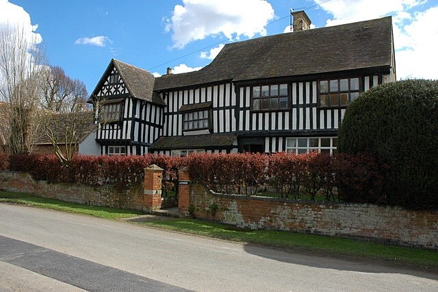
Photo: Philip Halling, CC BY-SA 2.0.
Ashchurch is a village and former civil parish, now in the parish of Ashchurch Rural, in the Tewkesbury district, in the county of Gloucestershire, England, 2 miles east of the town of Tewkesbury, 11 mi southwest of Evesham, 10 mi north of Cheltenham, 13 mi north-north-east of Gloucester and 10 mi south of Pershore.
Walton Cardiff
Hamlet

Photo: Philip Halling, CC BY-SA 2.0.
Walton Cardiff is a village and former civil parish, now in the parish of Ashchurch Rural, in the Borough of Tewkesbury, in Gloucestershire, England. In 2001, the parish had a population of 1291.
Tewkesbury
 Tewkesbury is a small market town in north Gloucestershire, approximately 11 mi north of the city of Gloucester and 9 mi north of Cheltenham. It is renowned for its medieval streetscape and large number of timber framed buildings.
BP
- Type: Gas station
- Categories: building, canopy, and transportation
- Location: Northway, Tewkesbury, Gloucestershire, West Country, England, United Kingdom, Britain and Ireland, Europe
- View on OpenStreetMap
Latitude
51.99642° or 51° 59′ 47″ northLongitude
-2.11647° or 2° 6′ 59″ westBrand
BPOpen location code
9C3VXVWM+HCOpenStreetMap ID
way 817162927OpenStreetMap feature
amenity=fuelOpenStreetMap feature
building=roof
This page is based on OpenStreetMap, Wikidata, and Wikimedia Commons.
We’d love your help improving our open data sources. Thank you for contributing.
Satellite Map
Discover BP from above in high-definition satellite imagery.
Notable Places Nearby
Highlights include Ashchurch Village Hall and Northway Community Hub & Parish Office.
Nearby Places
Explore places such as M&S Simply Food and BP.
Gloucestershire: Must-Visit Destinations
Delve into Gloucester, Cheltenham, Cirencester, and Yate.
Curious Gas Stations to Discover
Uncover intriguing gas stations from every corner of the globe.
About Mapcarta. Data © OpenStreetMap contributors and available under the Open Database License". Text is available under the CC BY-SA 4.0 license, except for photos, directions, and the map. Photo: Matthew Hartley, CC BY-SA 2.0.