Flügge Am Deich 1
Flügge Am Deich 1 is an electrical substation in Fehmarn, Ostholstein, Schleswig-Holstein. Flügge Am Deich 1 is situated nearby to the scenic viewpoint Fehmarn Flügge, as well as near the pond Flügger Watt.| Tap on a place to explore it |
Places of Interest Nearby
Highlights include Fehmarn Flügge and Krummsteert-Sulsdorfer Wiek / Fehmarn.
Fehmarn Flügge
Scenic viewpoint
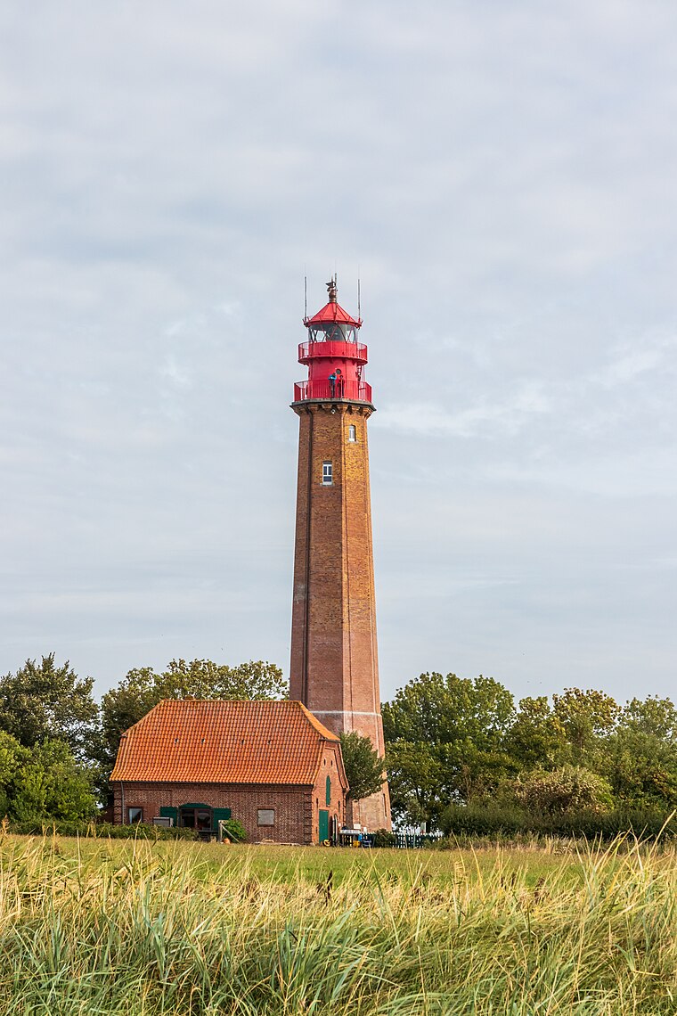
Photo: Matthias Süßen, CC BY-SA 4.0.
Fehmarn Flügge is a scenic viewpoint, which is situated 380 metres southwest of Flügge Am Deich 1.
Krummsteert-Sulsdorfer Wiek / Fehmarn
Nature reserve

Photo: Friedjof, CC BY-SA 3.0.
Krummsteert-Sulsdorfer Wiek / Fehmarn is a nature reserve.
Places in the Area
Nearby places include Orth and Petersdorf auf Fehmarn.

Petersdorf auf Fehmarn
Village

Photo: Superbass, CC BY-SA 4.0.
Petersdorf auf Fehmarn is a village, which is situated 5 km northeast of Flügge Am Deich 1.
Albertsdorf auf Fehmarn
Village
 Albertsdorf auf Fehmarn is a village, which is situated 6 km east of Flügge Am Deich 1.
Flügge Am Deich 1
- Type: Electrical substation
- Category: industry
- Location: Fehmarn, Ostholstein, East Holstein, Schleswig-Holstein, Germany, Central Europe, Europe
- View on OpenStreetMap
Latitude
54.44377° or 54° 26′ 38″ northLongitude
11.02102° or 11° 1′ 16″ eastOperator
Schleswig-Holstein Netz AGOpen location code
9F6HC2VC+GCOpenStreetMap ID
way 835831393OpenStreetMap feature
man_made=street_cabinet
This page is based on OpenStreetMap, Wikidata, and Wikimedia Commons.
We’d love your help improving our open data sources. Thank you for contributing.
Satellite Map
Discover Flügge Am Deich 1 from above in high-definition satellite imagery.
Notable Places Nearby
Highlights include Flügger Watt and Krummsteert.
Nearby Places
Explore places such as Kläranlage Orth and Hof Flügge.
East Holstein: Must-Visit Destinations
Delve into Lübeck, Ratzeburg, Timmendorfer Strand, and Grömitz.
Curious Electrical Substations to Discover
Uncover intriguing electrical substations from every corner of the globe.
About Mapcarta. Data © OpenStreetMap contributors and available under the Open Database License". Text is available under the CC BY-SA 4.0 license, except for photos, directions, and the map. Photo: Wikimedia, Public domain.