Low Rigg
Low Rigg is a building in Stanhope, County Durham, England. Low Rigg is situated nearby to the forest Ullsfield Plantation, as well as near the village Wearhead.| Tap on a place to explore it |
Places of Interest Nearby
Highlights include Wearhead Primary School and Weardale Museum.
Wearhead Primary School
School

Photo: Victuallers, CC BY-SA 4.0.
Wearhead Primary School is situated 1,800 feet north of Low Rigg.
Weardale Museum
Museum
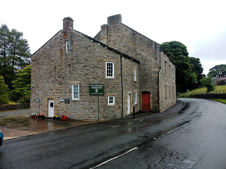
Photo: Victuallers, CC BY-SA 4.0.
Weardale Museum is situated 1 mile east of Low Rigg.
St Thomas‘ Church
Church

Photo: Victuallers, CC BY-SA 4.0.
St Thomas‘ Church is situated 1 mile north of Low Rigg.
Places in the Area
Nearby places include Wearhead and West Blackdene.
Wearhead
Village
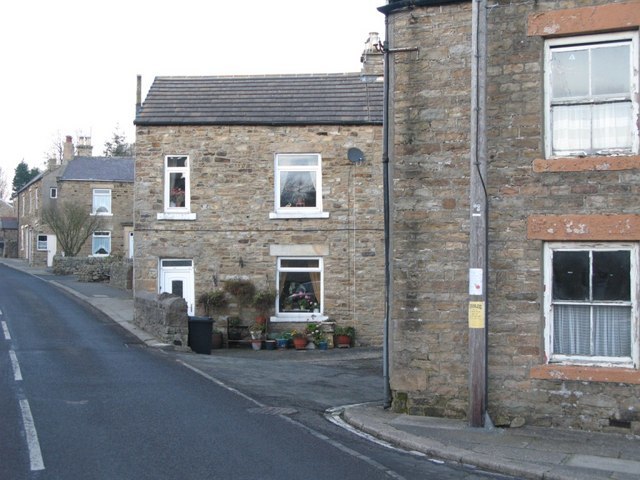
Photo: Mike Quinn, CC BY-SA 2.0.
Wearhead is a village in the civil parish of Stanhope, in County Durham, England. It is situated at the top of Weardale between Cowshill and Ireshopeburn.
West Blackdene
Hamlet
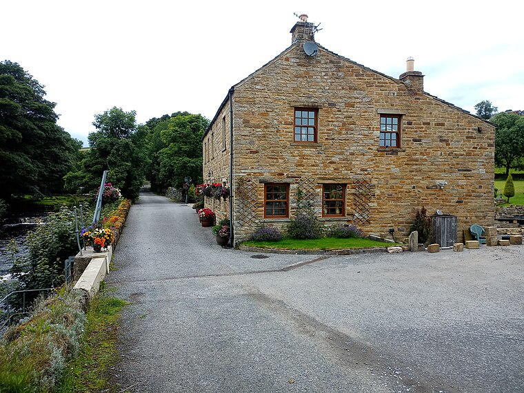
Photo: Victuallers, CC BY-SA 4.0.
West Blackdene is a village in the civil parish of Stanhope, in County Durham, England. It is situated to the north of the River Wear, opposite Ireshopeburn. In the 2001 census West Blackdene had a population of 37.
Ireshopeburn
Village

Photo: Andrew Smith, CC BY-SA 2.0.
Ireshopeburn is a village in the civil parish of Stanhope, in County Durham, England. It is situated on the south side of Weardale, between St John's Chapel and Wearhead, and on the other side of the Wear from West Blackdene and New House.
Low Rigg
- Type: Building
- Location: Stanhope, County Durham, North East England, England, United Kingdom, Britain and Ireland, Europe
- View on OpenStreetMap
Latitude
54.74668° or 54° 44′ 48″ northLongitude
-2.22437° or 2° 13′ 28″ westOpen location code
9C6VPQWG+M7OpenStreetMap ID
way 839148942OpenStreetMap feature
building=yes
This page is based on OpenStreetMap, Wikidata, and Wikimedia Commons.
We’d love your help improving our open data sources. Thank you for contributing.
Satellite Map
Discover Low Rigg from above in high-definition satellite imagery.
Places with the Same Name
Discover other places named “Low Rigg”.
Notable Places Nearby
Highlights include Ullsfield Plantation and Hole Plantation.
Nearby Places
Explore places such as Wham and Middle Rigg.
County Durham: Must-Visit Destinations
Delve into Durham, Darlington, Hartlepool, and Stockton-on-Tees.
Curious Buildings to Discover
Uncover intriguing buildings from every corner of the globe.
About Mapcarta. Data © OpenStreetMap contributors and available under the Open Database License". Text is available under the CC BY-SA 4.0 license, except for photos, directions, and the map. Photo: Andrew Curtis, CC BY-SA 2.0.