Tour 16 D
Tour 16 D is a building in Bondy, Arrondissement of Bobigny, Île-de-France which is located on Boulevard Jacques Decour - Cité voie verte. Tour 16 D is situated nearby to the sports venue Gymnase Jacques Decour, as well as near the park square Lucette Meignant.| Tap on a place to explore it |
Places of Interest Nearby
Highlights include Le Blanc-Mesnil station and Cimetière intercommunal de Bondy - Le Pré-Saint-Gervais.
Le Blanc-Mesnil station
Railway station

Photo: Geralix, CC BY-SA 3.0.
Le Blanc-Mesnil station is a station on the line B of the Réseau Express Régional, a hybrid suburban commuter and rapid transit line. It is named after the village of Blanc-Mesnil where the station is located. Le Blanc-Mesnil station is situated 1¼ km north of Tour 16 D.
Cimetière intercommunal de Bondy - Le Pré-Saint-Gervais
Cemetery

Photo: Chabe01, CC BY-SA 4.0.
Cimetière intercommunal de Bondy - Le Pré-Saint-Gervais is a cemetery, which is situated 1 km east of Tour 16 D.
Aulnay-sous-Bois station
Railway station
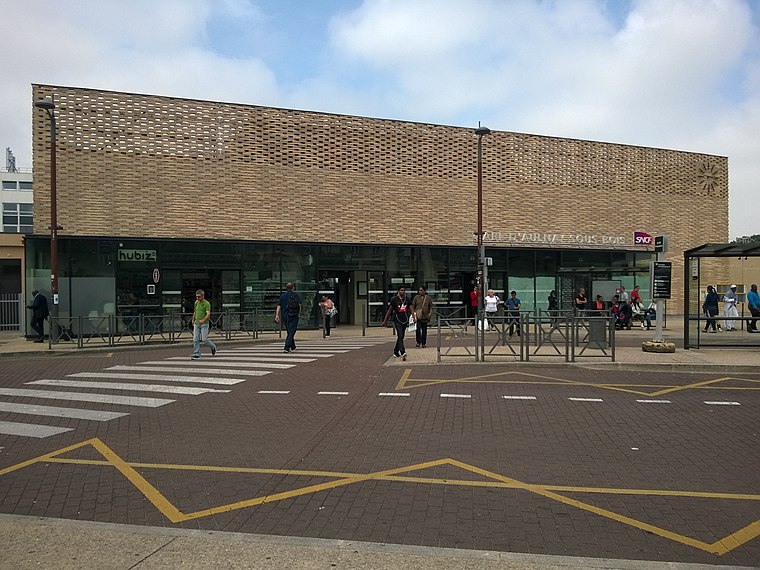
Photo: Skililipappa, CC BY-SA 4.0.
Aulnay-sous-Bois station is the major railway station in the town of Aulnay-sous-Bois, in the department of Seine-Saint-Denis). It is on the RER B and the Transilien K lines. The station is also the terminus for tramway T4. Aulnay-sous-Bois station is situated 2 km northeast of Tour 16 D.
Places in the Area
Nearby places include Bondy and Le Blanc-Mesnil.
Bondy
Town

Photo: Chabe01, CC BY-SA 4.0.
Bondy is a commune in the northeastern suburbs of Paris, France. It is located 10.9 km from the centre of Paris, in the Seine-Saint-Denis department.
Le Blanc-Mesnil
Town

Photo: Wikimedia, CC BY-SA 3.0.
Le Blanc-Mesnil is a commune in the northeastern suburbs of Paris, France. It is located 12.6 km from the center of Paris, between Charles de Gaulle Airport and Le Bourget Airport.
Aulnay-sous-Bois
Town

Photo: Suaudeau, CC BY-SA 3.0.
Aulnay-sous-Bois is a commune in the Seine-Saint-Denis department in the Île-de-France region in the north-eastern suburbs of Paris, France. It is located 13.9 km from the Kilometre zero of France.
Tour 16 D
- Type: Building
- Address: Boulevard Jacques Decour - Cité voie verte, Le Blanc-Mesnil, 93150
- Location: Bondy, Arrondissement of Bobigny, Seine-Saint-Denis, Île-de-France, France, Europe
- View on OpenStreetMap
Latitude
48.9205° or 48° 55′ 14″ northLongitude
2.47685° or 2° 28′ 37″ eastOpen location code
8FW4WFCG+6POpenStreetMap ID
way 84295495OpenStreetMap feature
building=yes
This page is based on OpenStreetMap, Wikidata, and Wikimedia Commons.
We’d love your help improving our open data sources. Thank you for contributing.
Satellite Map
Discover Tour 16 D from above in high-definition satellite imagery.
Notable Places Nearby
Highlights include Gymnase Jacques Decour and square Lucette Meignant.
Nearby Places
Explore places such as Cité Jacques Decours and Bâtiment E.
Île-de-France: Must-Visit Destinations
Delve into Paris, Versailles, Boulogne-Billancourt, and Paris Charles de Gaulle Airport.
Curious Buildings to Discover
Uncover intriguing buildings from every corner of the globe.
About Mapcarta. Data © OpenStreetMap contributors and available under the Open Database License". Text is available under the CC BY-SA 4.0 license, except for photos, directions, and the map. Photo: Romain D C, CC BY-SA 3.0.