Molí de Cal Messeguer
Molí de Cal Messeguer is a building in Cànoves i Samalús, Barcelona, Catalonia. Molí de Cal Messeguer is situated nearby to the post office Oficina de Correos, as well as near the playground Parc Infantil de la Pl. de St. Muç.| Tap on a place to explore it |
Places of Interest Nearby
Highlights include Sant Muç de Cànoves and Poblat ibèric de Puig del Castell.
Sant Muç de Cànoves
Church
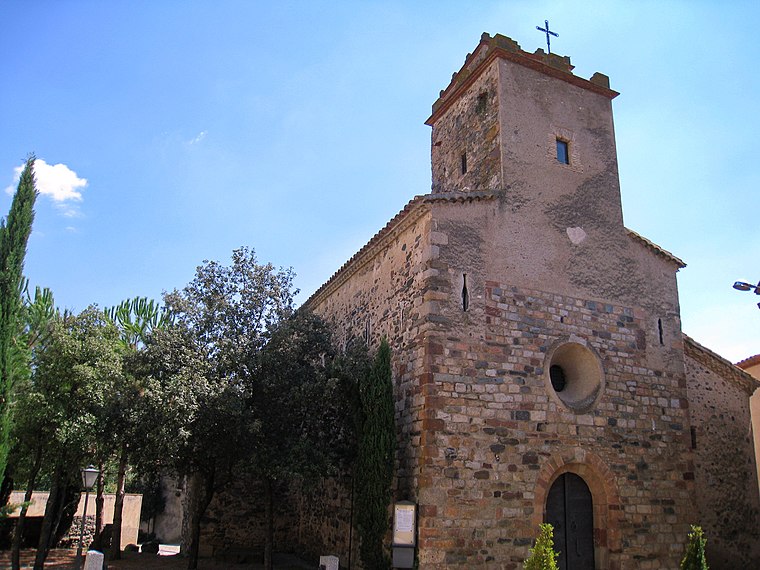
Photo: Amadalvarez, CC BY-SA 4.0.
Sant Muç de Cànoves is a church, which is situated 360 metres south of Molí de Cal Messeguer.
Poblat ibèric de Puig del Castell
Archaeological site

Photo: RubnM, CC BY-SA 4.0.
Poblat ibèric de Puig del Castell is an archaeological site, which is situated 2½ km west of Molí de Cal Messeguer.
Roca Centella
Peak

Photo: Pere prlpz, CC BY-SA 4.0.
Roca Centella is a mountain of Catalonia, Spain. It has an elevation of 1,000 metres above sea level. This mountain is part of the Catalan Pre-Coastal Range. The name of the mountain means "Lightning Rock" in the Catalan language. Roca Centella is situated 4 km northwest of Molí de Cal Messeguer.
Places in the Area
Nearby places include Cànoves i Samalús and Sant Pere de Vilamajor.

Sant Pere de Vilamajor
Village

Photo: Orila872, Public domain.
Sant Pere de Vilamajor is a village in the province of Barcelona and autonomous community of Catalonia, Spain. The municipality covers an area of 13.8 square kilometres and the population in 2014 was 4,248. Sant Pere de Vilamajor is situated 3 km southeast of Molí de Cal Messeguer.
Samalús
Neighborhood

Photo: Pere prlpz, CC BY-SA 4.0.
Samalús is a neighborhood, which is situated 3½ km west of Molí de Cal Messeguer.
Molí de Cal Messeguer
- Type: Building
- Location: Cànoves i Samalús, Barcelona, Catalonia, Eastern Spain, Spain, Iberia, Europe
- View on OpenStreetMap
Latitude
41.69649° or 41° 41′ 47″ northLongitude
2.35527° or 2° 21′ 19″ eastOpen location code
8FH4M9W4+H4OpenStreetMap ID
way 844008465OpenStreetMap feature
building=yes
This page is based on OpenStreetMap, Wikidata, and Wikimedia Commons.
We’d love your help improving our open data sources. Thank you for contributing.
Satellite Map
Discover Molí de Cal Messeguer from above in high-definition satellite imagery.
Notable Places Nearby
Highlights include Cal Messeguer and Oficina de Correos.
Nearby Places
Explore places such as Llenyes Cuch and Farmàcia Basté Sabé, M. Immaculada.
Barcelona: Must-Visit Destinations
Delve into Barcelona, Malgrat de Mar, Terrassa, and Badalona.
Curious Buildings to Discover
Uncover intriguing buildings from every corner of the globe.
About Mapcarta. Data © OpenStreetMap contributors and available under the Open Database License". Text is available under the CC BY-SA 4.0 license, except for photos, directions, and the map. Photo: Alex Micheu Photography, CC BY-SA 3.0.