Premier Inn
Premier Inn is a hotel in Liverpool, England which is located on Queens Drive. Premier Inn is situated nearby to Bankfield Park, as well as near the pitch West Derby Recreational Crown Green Bowls Club.| Tap on a place to explore it |
Places of Interest Nearby
Highlights include St James’ Church, West Derby, Liverpool and Holly Lodge Girls’ College.
St James’ Church, West Derby, Liverpool
Church
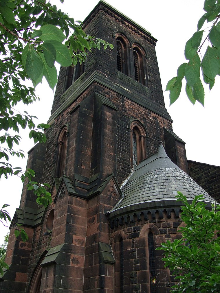
Photo: Wikimedia, CC BY-SA 2.0.
St James' Church is in Mill Lane, West Derby, a suburb of Liverpool, Merseyside, England. It was an active Anglican parish church in the deanery of West Derby, the archdeaconry of Liverpool, and the diocese of Liverpool until 23 June 2019 when responsibility was handed over to the Indian Orthodox Church. St James’ Church, West Derby, Liverpool is situated 1,200 feet east of Premier Inn.
Holly Lodge Girls’ College
School
Holly Lodge Girls' College is an 11–18 girls, community secondary school and sixth form in West Derby, Liverpool, Merseyside, England. It was established in 1922. Holly Lodge Girls’ College is situated 1,000 feet northeast of Premier Inn.
West Derby School
School
West Derby School is a comprehensive all-boys academy based in Liverpool, England. The school was converted from a Local education authority school to academy status on 1 September 2012. West Derby School is situated 1,400 feet southwest of Premier Inn.
Places in the Area
Nearby places include Walton and Everton.
Walton
Suburb

Photo: Rept0n1x, CC BY-SA 3.0.
Walton is an area of Liverpool, in Merseyside, England, north of Anfield and east of Bootle and Orrell Park. Historically in Lancashire, it is largely residential, with a diverse population. Walton is situated 2 miles northwest of Premier Inn.
Everton
Suburb

Photo: KGGucwa, CC BY-SA 3.0.
Everton is a suburb of north Liverpool, in Merseyside, England, and part of the Liverpool Walton constituency. It is bordered by Vauxhall to the west, Kirkdale to the north, and Anfield to the north-east. Everton is situated 2½ miles west of Premier Inn.
Stockbridge Village
Suburb
Stockbridge Village is an area of Knowsley in Merseyside, England. The population of the ward at the 2011 census was 6,018. Up until 1983, the area was formerly known as Cantril Farm, and was the subject of an article in a special report by The Economist entitled "A new kind of ghetto", which described it a predominantly White area of high unemployment and low aspirations. Stockbridge Village is situated 2½ miles east of Premier Inn.
Premier Inn
- Type: Hotel
- Address: Queens Drive, Liverpool, L13 0DL
- Categories: building, tourism, and accommodation
- Location: Liverpool, England, United Kingdom, Britain and Ireland, Europe
- View on OpenStreetMap
Latitude
53.42657° or 53° 25′ 36″ northLongitude
-2.91894° or 2° 55′ 8″ westBrand
Premier InnOpen location code
9C5VC3GJ+JCOpenStreetMap ID
way 852017036OpenStreetMap feature
building=yesOpenStreetMap feature
tourism=hotel
This page is based on OpenStreetMap, Wikidata, and Wikimedia Commons.
We’d love your help improving our open data sources. Thank you for contributing.
Satellite Map
Discover Premier Inn from above in high-definition satellite imagery.
Places with the Same Name
Discover other places named “Premier Inn”.
Notable Places Nearby
Highlights include Bankfield Park and West Derby Recreational Crown Green Bowls Club.
Nearby Places
Explore places such as MILL BANK/STAG AND RAINBOW and Stag and Rainbow.
England: Must-Visit Destinations
Delve into London, Manchester, Sheffield, and Leeds.
Curious Hotels to Discover
Uncover intriguing hotels from every corner of the globe.
About Mapcarta. Data © OpenStreetMap contributors and available under the Open Database License". Text is available under the CC BY-SA 4.0 license, except for photos, directions, and the map. Photo: sidibousaid, CC BY 2.0.