Green Lane Dental Centre
Green Lane Dental Centre is a dental clinic in Bromley, Greater London, England which is located on Green Lane. Green Lane Dental Centre is situated nearby to Penge Library, as well as near the school Harris Primary Academy Kent House.| Tap on a place to explore it |
Places of Interest Nearby
Highlights include Kent House railway station and Penge Congregational Church.
Kent House railway station
Railway station

Photo: TheFrog001, CC0.
Kent House railway station is on the Chatham Main Line in England, serving part of the Penge and Beckenham areas in the London Borough of Bromley, south London. Kent House railway station is situated 1,400 feet southeast of Green Lane Dental Centre.
Penge Congregational Church
Church

Photo: QuintusPetillius, CC BY-SA 4.0.
Penge Congregational Church is a Congregational church in Penge in the London Borough of Bromley located on Penge High Street. It is organised under Congregational principles for all who believe in Jesus and is run under a basis of fellowship that includes all members of the church. Penge Congregational Church is situated 1,000 feet south of Green Lane Dental Centre.
Penge West railway station
Railway station

Photo: Sunil060902, CC BY-SA 3.0.
Penge West is a station on the Windrush line of the London Overground, located in Penge, a district of the London Borough of Bromley in south London. It is 7 miles 15 chains down the line from London Bridge, in Travelcard Zone 4. Penge West railway station is situated 2,600 feet west of Green Lane Dental Centre.
Places in the Area
Nearby places include Penge and Anerley.
Penge
Suburb

Photo: P Ingerson, Public domain.
Penge is a suburb of South East London, England, now in the London Borough of Bromley, 3.5 miles west of Bromley, 3.7 miles north east of Croydon and 7.1 miles south east of Charing Cross.
Anerley
Suburb

Photo: Dr Neil Clifton, CC BY-SA 2.0.
Anerley is suburb of south east London, England, within the London Borough of Bromley. It is located 7 miles south south-east of Charing Cross, to the south of Upper Norwood, west of Penge, north of Elmers End and east of South Norwood.
Sydenham
Town
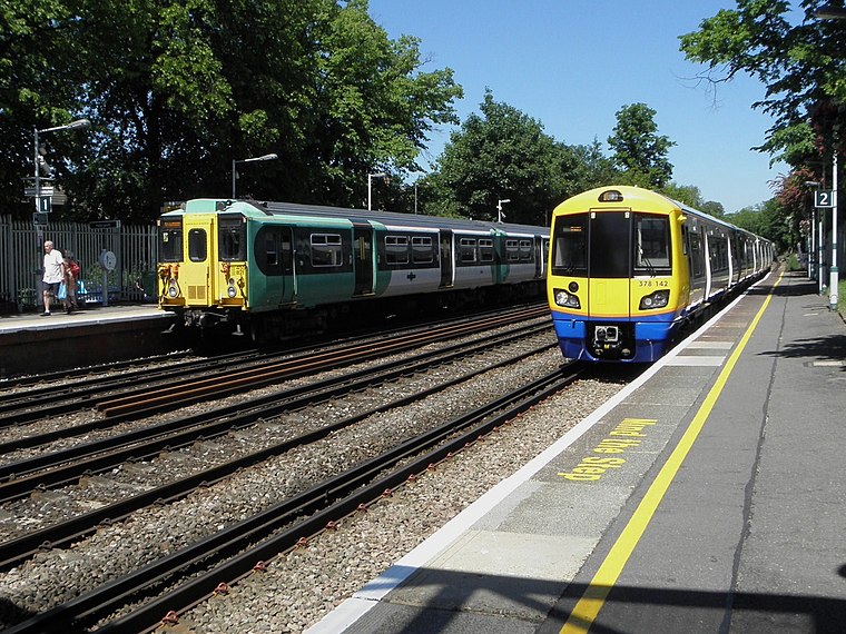
Photo: Sunil060902, CC BY-SA 3.0.
Sydenham is a district of south-east London, England, which is shared between the London boroughs of Lewisham, Bromley and Southwark. Prior to the creation of the County of London in 1889, Sydenham was located in Kent, bordering Surrey.
Green Lane Dental Centre
- Type: Dental clinic
- Address: 17 Green Lane, London, SE20 7AJ
- Categories: health care and building
- Location: Bromley, Greater London, England, United Kingdom, Britain and Ireland, Europe
- View on OpenStreetMap
Latitude
51.41487° or 51° 24′ 54″ northLongitude
-0.0499° or 0° 2′ 60″ westOpen location code
9C3XCX72+W2OpenStreetMap ID
way 852141521OpenStreetMap feature
amenity=dentistOpenStreetMap feature
building=yesOpenStreetMap feature
healthcare=dentist
This page is based on OpenStreetMap, Wikidata, and Wikimedia Commons.
We’d love your help improving our open data sources. Thank you for contributing.
Satellite Map
Discover Green Lane Dental Centre from above in high-definition satellite imagery.
Notable Places Nearby
Highlights include Penge Library and The Moon & Stars.
Nearby Places
Explore places such as Friends Of Flavours and Parish Lane.
England: Must-Visit Destinations
Delve into London, Manchester, Sheffield, and Leeds.
Curious Dental Clinics to Discover
Uncover intriguing dental clinics from every corner of the globe.
About Mapcarta. Data © OpenStreetMap contributors and available under the Open Database License". Text is available under the CC BY-SA 4.0 license, except for photos, directions, and the map. Photo: Mario modesto, CC BY-SA 3.0.