Puente Hills Preserve
Puente Hills Preserve is a nature reserve in Los Angeles, Southern California, California. Puente Hills Preserve is situated nearby to the suburb Rose Hills, as well as near the hamlet Hillgrove.| Tap on a place to explore it |
Places of Interest
Highlights include San Gabriel Valley and Workman Hill.
San Gabriel Valley

Photo: Wikimedia, CC BY-SA 2.0.
The San Gabriel Valley in Southern California is a region of Los Angeles County. Stretching from Pasadena to Pomona at the foothills of the San Gabriel Mountains to the north, the valley encompasses numerous suburban communities to the northeast of Downtown Los Angeles.


Places in the Area
Nearby places include Hacienda Heights and Whittier.
Hacienda Heights
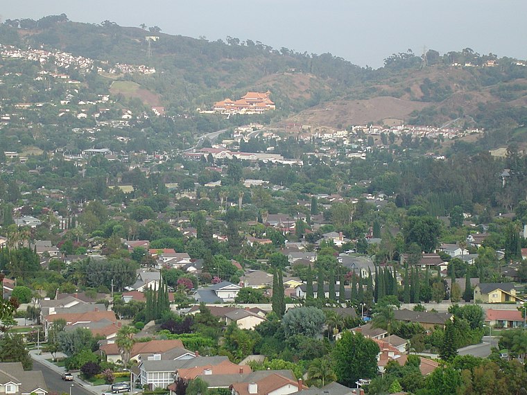
Photo: Geographer, CC BY 1.0.
Hacienda Heights is an unincorporated community in Los Angeles County, California, United States. As of the 2020 census, the community had a total population of 54,191, up from 54,038 at the 2010 census.
Whittier
 Whittier is a city of 86,000 in Los Angeles County in Southern California. It was founded by Quakers in 1887 and incorporated in 1898.
La Puente
Town

Photo: Los Angeles, CC BY-SA 4.0.
La Puente is a city in east Los Angeles County, California, United States. The city had a population of 38,062 at the 2020 census and is approximately 20 miles east of Downtown Los Angeles.
Puente Hills Preserve
- Type: Nature reserve
- Category: recreation area
- Location: Los Angeles, Southern California, California, United States, North America
- View on OpenStreetMap
Latitude
34.0054° or 34° 0′ 20″ northLongitude
-118.0024° or 118° 0′ 9″ westOperator
Puente Hills Habitat Preservation AuthorityOpen location code
85632X4X+52OpenStreetMap ID
way 865482405OpenStreetMap feature
leisure=nature_reserve
This page is based on OpenStreetMap, Wikidata, and Wikimedia Commons.
We’d love your help improving our open data sources. Thank you for contributing.
Satellite Map
Discover Puente Hills Preserve from above in high-definition satellite imagery.
Places with the Same Name
Discover other places named “Puente Hills Preserve”.
Localities in the Area
Explore places such as Rose Hills and Hillgrove.
Notable Places Nearby
Highlights include Hacienda Hills Trailhead and Whittier Hill.
Los Angeles: Must-Visit Destinations
Delve into Hollywood, San Gabriel Valley, San Fernando Valley, and Long Beach.
Curious Nature Reserves to Discover
Uncover intriguing nature reserves from every corner of the globe.
About Mapcarta. Data © OpenStreetMap contributors and available under the Open Database License". Text is available under the CC BY-SA 4.0 license, except for photos, directions, and the map. Photo: Mfield, CC BY-SA 3.0.