St Oswald’s Church Hall
St Oswald’s Church Hall is a building in Gloucester District, Gloucestershire, England which is located on Coney Hill Road. St Oswald’s Church Hall is situated nearby to St Oswald’s Churchyard, as well as near St Oswald’s Church, Coney Hill.| Tap on a place to explore it |
Places of Interest Nearby
Highlights include Church of St Lawrence and Church Of St Aldate.
Church of St Lawrence
Church

Photo: David Stowell, CC BY-SA 2.0.
Church of St Lawrence is situated 2,800 feet northeast of St Oswald’s Church Hall.
Church Of St Aldate
Church

Photo: Philip Halling, CC BY-SA 2.0.
Church Of St Aldate is situated 3,700 feet southwest of St Oswald’s Church Hall.
Gloucestershire Royal Hospital
Hospital
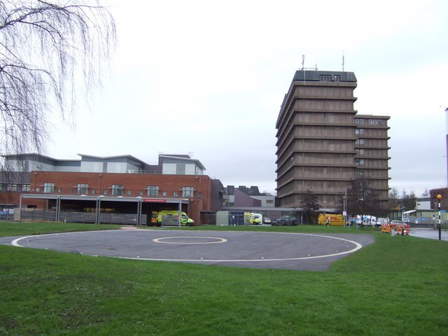
Photo: Jonathan Billinger, CC BY-SA 2.0.
Gloucestershire Royal Hospital is an acute District General Hospital on the Great Western Road in Gloucester operated by the Gloucestershire Hospitals NHS Foundation Trust. Gloucestershire Royal Hospital is situated 1¼ miles northwest of St Oswald’s Church Hall.
Places in the Area
Nearby places include Coopers Edge and Bondend.
Coopers Edge
Hamlet
Coopers Edge is a suburb of Gloucestershire, United Kingdom. It is located in Brockworth and Upton St Leonards, between the city of Gloucester and the town of Cheltenham. Coopers Edge is situated 1½ miles southeast of St Oswald’s Church Hall.
Bondend
Hamlet

Photo: Graham Hogg, CC BY-SA 2.0.
Bondend is a lane within the village of Upton St Leonards in Gloucestershire, England. Bondend is situated 1½ miles southeast of St Oswald’s Church Hall.
Gloucester

Photo: Traveler100, CC BY-SA 4.0.
Gloucester is the county town of Gloucestershire in England's West Country. A major attraction of the city is Gloucester Cathedral, which is the burial place of King Edward II.
St Oswald’s Church Hall
- Type: Building
- Address: Coney Hill Road, Gloucester, GL4 4LX
- Location: Gloucester District, Gloucestershire, West Country, England, United Kingdom, Britain and Ireland, Europe
- View on OpenStreetMap
Latitude
51.85234° or 51° 51′ 8″ northLongitude
-2.21481° or 2° 12′ 53″ westLevels
1Open location code
9C3VVQ2P+W3OpenStreetMap ID
way 869078300OpenStreetMap feature
building=yes
This page is based on OpenStreetMap, Wikidata, and Wikimedia Commons.
We’d love your help improving our open data sources. Thank you for contributing.
Satellite Map
Discover St Oswald’s Church Hall from above in high-definition satellite imagery.
Places with the Same Name
Discover other places named “St Oswald’s Church Hall”.
Notable Places Nearby
Highlights include St Oswald’s Churchyard and St Oswald’s Church, Coney Hill.
Nearby Places
Explore places such as Coney Hill Food Hub and Vestry Gardens.
Gloucestershire: Must-Visit Destinations
Delve into Gloucester, Cheltenham, Cirencester, and Yate.
Curious Buildings to Discover
Uncover intriguing buildings from every corner of the globe.
About Mapcarta. Data © OpenStreetMap contributors and available under the Open Database License". Text is available under the CC BY-SA 4.0 license, except for photos, directions, and the map. Photo: Matthew Hartley, CC BY-SA 2.0.