Altheubichlteich
Altheubichlteich is a pond in Blindenmarkt, Melk District, Lower Austria. Altheubichlteich is situated nearby to the pond Forsthausteich, as well as near the peak Burgstaller Kogel.| Tap on a place to explore it |
Places of Interest Nearby
Highlights include Schloss Hubertendorf Blindenmarkt and Pfarrkirche St. Martin-Karlsbach.
Schloss Hubertendorf Blindenmarkt
Castle
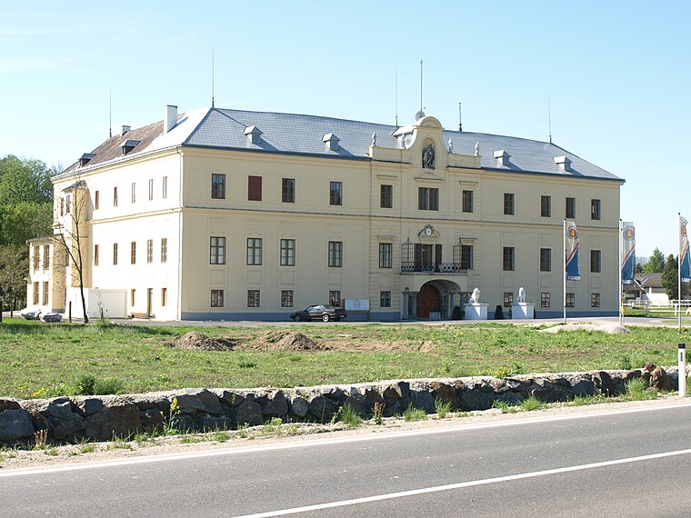 Schloss Hubertendorf Blindenmarkt is a castle, which is situated 2½ km southeast of Altheubichlteich.
Pfarrkirche St. Martin-Karlsbach
Church
 Pfarrkirche St. Martin-Karlsbach is a church, which is situated 3 km northeast of Altheubichlteich.
Parish church of St. Georgen am Ybbsfelde
Church

Photo: Bwag, CC BY-SA 4.0.
Parish church of St. Georgen am Ybbsfelde is situated 3½ km southwest of Altheubichlteich.
Places in the Area
Nearby places include Persenbeug and Amstetten.
Persenbeug
Village

Photo: Bwag, CC BY-SA 4.0.
Persenbeug is a village, which is situated 8 km northeast of Altheubichlteich.
Amstetten

Photo: Andrzej O, CC BY-SA 4.0.
Amstetten is an industrial city in Lower Austria and the economic centre of the Mostviertel. The city has about 23,000 inhabitants.
Altheubichlteich
- Type: Pond
- Category: body of water
- Location: Blindenmarkt, Melk District, Lower Austria, Austria, Central Europe, Europe
- View on OpenStreetMap
Latitude
48.1436° or 48° 8′ 37″ northLongitude
14.99438° or 14° 59′ 40″ eastOpen location code
8FWP4XVV+CQOpenStreetMap ID
way 903707766OpenStreetMap feature
natural=waterOpenStreetMap feature
water=pond
This page is based on OpenStreetMap, Wikidata, and Wikimedia Commons.
We’d love your help improving our open data sources. Thank you for contributing.
Satellite Map
Discover Altheubichlteich from above in high-definition satellite imagery.
Notable Places Nearby
Highlights include Forsthausteich and Burgstaller Kogel.
Nearby Places
Explore places such as Andreas Tiefenbacher and Gülle.
Lower Austria: Must-Visit Destinations
Delve into St. Pölten, Wiener Neustadt, Amstetten, and Klosterneuburg.
Curious Ponds to Discover
Uncover intriguing ponds from every corner of the globe.
About Mapcarta. Data © OpenStreetMap contributors and available under the Open Database License". Text is available under the CC BY-SA 4.0 license, except for photos, directions, and the map. Photo: Lonezor, CC BY-SA 3.0.