Shah Abul Khair Dargah
Shah Abul Khair Dargah is a mosque in Kotwali, Central Delhi, Delhi. Shah Abul Khair Dargah is situated nearby to the mosque Shrine of Turkman Bayabani Masjid, as well as near Anjuman Masjid.| Tap on a place to explore it |
Places of Interest Nearby
Highlights include Red Fort, Delhi and New Delhi railway station.
Red Fort, Delhi

Photo: Planemad, CC BY-SA 2.5.
The Red Fort, also known as Lal Qila is a historic Mughal fort located in the Old Delhi area of Delhi, India. It served as the main residence of the Mughal emperors. Red Fort, Delhi is situated 1½ km northeast of Shah Abul Khair Dargah.
New Delhi railway station
Railway station
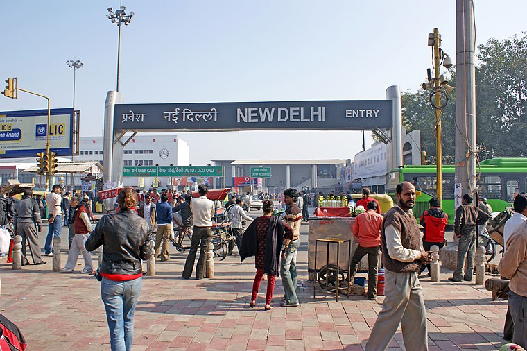
Photo: Quoique, CC BY-SA 3.0.
New Delhi railway station is the primary railway hub for the Indian capital, New Delhi, and an integral part of Indian Railways. Situated in Central Delhi, approximately 2 kilometers north of Connaught Place, the station features 16 platforms with entrances at Paharganj and Ajmeri Gate. New Delhi railway station is situated 1¼ km west of Shah Abul Khair Dargah.
Delhi Gate

Photo: Harshanh, CC BY-SA 4.0.
Delhi Gate is the southern gate in the historic walled city of Delhi, or Shahjahanabad in 1638 AD. The gate links the New Delhi city with the old walled city of Delhi. Delhi Gate is situated 780 metres southeast of Shah Abul Khair Dargah.
Places in the Area
Nearby places include Chawri Bazar and Meena Bazar, Old Delhi.
Chawri Bazar
Neighborhood

Photo: Wikimedia, CC BY-SA 4.0.
Chawri Bazar is a specialized wholesale market of brass, copper and paper products. Established in 1840, with a hardware market, it was the first wholesale market of Old Delhi it lies to the west of Jama Masjid in Delhi.
Meena Bazar, Old Delhi
Neighborhood

Photo: Pinakpani, CC BY-SA 4.0.
Meena Bazar, Old Delhi is a neighborhood.
Chandni Chowk
Neighborhood

Photo: Bahnfrend, CC BY-SA 3.0.
The Chandni Chowk is one of the oldest and busiest markets in Old Delhi, India. There is another location in Pune with the name Chandani Chowk. Located close to the Old Delhi railway station, the Mughal-era Red Fort is located at the eastern fringes of Chandni Chowk.
Shah Abul Khair Dargah
- Type: Mosque
- Categories: building, place of worship, and religion
- Location: Kotwali, Central Delhi, Delhi, Plains, India, South Asia, Asia
- View on OpenStreetMap
Latitude
28.64483° or 28° 38′ 41″ northLongitude
77.2337° or 77° 14′ 1″ eastOpen location code
7JWVJ6VM+WFOpenStreetMap ID
way 904492408OpenStreetMap feature
amenity=place_of_worshipOpenStreetMap feature
building=yes
This page is based on OpenStreetMap, Wikidata, and Wikimedia Commons.
We’d love your help improving our open data sources. Thank you for contributing.
Satellite Map
Discover Shah Abul Khair Dargah from above in high-definition satellite imagery.
Notable Places Nearby
Highlights include Shrine of Turkman Bayabani Masjid and Anjuman Masjid.
Nearby Places
Explore places such as DGD, Suiwalan and Bharat Petroleum.
Delhi: Must-Visit Destinations
Delve into New Delhi, Indira Gandhi International Airport, South East Delhi, and South Delhi.
Curious Mosques to Discover
Uncover intriguing mosques from every corner of the globe.
About Mapcarta. Data © OpenStreetMap contributors and available under the Open Database License". Text is available under the CC BY-SA 4.0 license, except for photos, directions, and the map. Photo: Knipptang, CC BY-SA 3.0.