Northfield Farm
Northfield Farm is a farm in Shipton, Cotswold District, England. Northfield Farm is situated nearby to the forest Cleevely Wood, as well as near the theater building The Axiom.| Tap on a place to explore it |
Places of Interest Nearby
Highlights include Church of St Oswald and The Mill House.
Church of St Oswald
Church

Photo: Philip Halling, CC BY-SA 2.0.
The Anglican Church of St Oswald at Shipton Oliffe in Shipton in the Cotswold District of Gloucestershire, England, was built in the 12th century. It is a grade I listed building. Church of St Oswald is situated 1 mile northeast of Northfield Farm.
The Mill House
Historic building
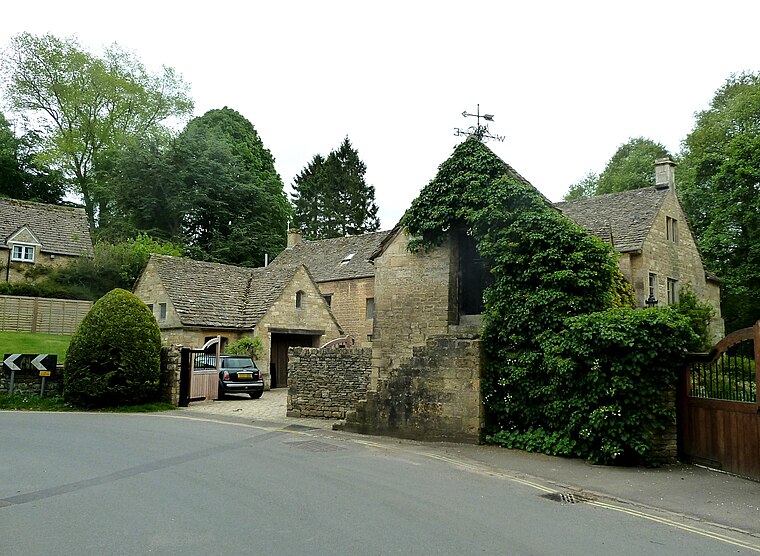
Photo: Rob Farrow, CC BY-SA 2.0.
The Mill House is a historic building, which is situated 1¼ miles south of Northfield Farm.
Frogmill Inn
Pub

Photo: Rob Farrow, CC BY-SA 2.0.
Frogmill Inn is a pub, which is situated 3,500 feet north of Northfield Farm.
Places in the Area
Nearby places include Withington and Foxcote.
Withington
Village

Photo: andy dolman, CC BY-SA 2.0.
Withington is a Cotswold village and civil parish in Gloucestershire, England, about 7 miles southeast of Cheltenham and 8 miles north of Cirencester. The River Coln runs through the village.

Dowdeswell
Hamlet
Dowdeswell is a civil parish in the ward of Chedworth, Cotswold, in the ceremonial county of Gloucestershire, England. It is separated into Upper and Lower Dowdeswell, the former being south of the latter. Dowdeswell is situated 2½ miles northwest of Northfield Farm.
Northfield Farm
- Type: Farm
- Category: agriculture
- Location: Shipton, Cotswold District, Gloucestershire, West Country, England, United Kingdom, Britain and Ireland, Europe
- View on OpenStreetMap
Latitude
51.85368° or 51° 51′ 13″ northLongitude
-1.96042° or 1° 57′ 38″ westOpen location code
9C3WV23Q+FROpenStreetMap ID
way 905955315OpenStreetMap feature
landuse=farmyard
This page is based on OpenStreetMap, Wikidata, and Wikimedia Commons.
We’d love your help improving our open data sources. Thank you for contributing.
Satellite Map
Discover Northfield Farm from above in high-definition satellite imagery.
Places with the Same Name
Discover other places named “Northfield Farm”.
Notable Places Nearby
Highlights include Cleevely Wood and The Axiom.
Nearby Places
Explore places such as Northfield Cottages and Thornhill.
Gloucestershire: Must-Visit Destinations
Delve into Gloucester, Cheltenham, Cirencester, and Yate.
Curious Farms to Discover
Uncover intriguing farms from every corner of the globe.
About Mapcarta. Data © OpenStreetMap contributors and available under the Open Database License". Text is available under the CC BY-SA 4.0 license, except for photos, directions, and the map. Photo: Matthew Hartley, CC BY-SA 2.0.