Plaza de los Coros
Plaza de los Coros is a park in Argentina. Plaza de los Coros is situated nearby to the police station Gendarmería Nacional, as well as near the park Plaza Eudoro Carrasco.| Tap on a place to explore it |
Places of Interest Nearby
Highlights include Rosario-Victoria Bridge and Balneario La Florida.
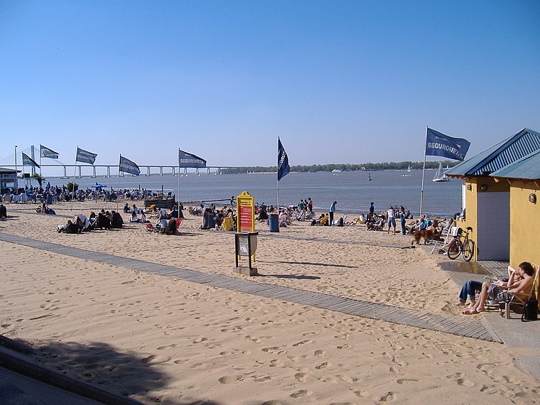
Rosario-Victoria Bridge
Bridge

Photo: Turkmenistan, CC0.
Rosario-Victoria Bridge is the informal name of the physical connection between the Argentine cities of Rosario and Victoria. This roadlink is composed of several bridges, viaducts and earth-filled sections. Rosario-Victoria Bridge is situated 1 km east of Plaza de los Coros.
Hospital Escuela Eva Perón
Hospital
Granadero Baigorria is a city in the south of the province of Santa Fe, Argentina, located directly north of Rosario, on the western shore of the Paraná River, and forming part of the Greater Rosario metropolitan area. Hospital Escuela Eva Perón is situated 2½ km northwest of Plaza de los Coros.
Places in the Area
Nearby places include Granadero Baigorria and Capitán Bermúdez.
Granadero Baigorria
Town

Photo: Egm ar, CC BY-SA 4.0.
Granadero Baigorria is a city in the south of the province of Santa Fe, Argentina, located directly north of Rosario, on the western shore of the Paraná River, and forming part of the Greater Rosario metropolitan area. Granadero Baigorria is situated 2½ km northwest of Plaza de los Coros.
Capitán Bermúdez
Town
Photo: Sofia cimolai, CC BY-SA 4.0.
Capitán Bermúdez is a city in the province of Santa Fe, Argentina, located within the metropolitan area of Greater Rosario, on the western shore of the Paraná River. Capitán Bermúdez is situated 7 km northwest of Plaza de los Coros.
Barrio Pichincha
Suburb
Pichincha is a barrio in the city of Rosario, province of Santa Fe, Argentina. It is located on the north-east part of the central area of the city, and its limits are Vera Mujica St, Cordoba St, Oroño Boulevard, and Del Valle Avenue. Barrio Pichincha is situated 8 km south of Plaza de los Coros.
Plaza de los Coros
- Type: Park
- Category: recreation area
- Location: Argentina, South America
- View on OpenStreetMap
Latitude
-32.87234° or 32° 52′ 20″ southLongitude
-60.68912° or 60° 41′ 21″ westOpen location code
47VX48H6+39OpenStreetMap ID
way 913193681OpenStreetMap feature
leisure=park
This page is based on OpenStreetMap, Wikidata, and Wikimedia Commons.
We’d love your help improving our open data sources. Thank you for contributing.
Satellite Map
Discover Plaza de los Coros from above in high-definition satellite imagery.
Notable Places Nearby
Highlights include Gendarmería Nacional and Plaza Eudoro Carrasco.
Nearby Places
Explore places such as 4626 and 72 - Costa Alta.
Argentina: Must-Visit Destinations
Delve into Buenos Aires, Misiones, Aconcagua, and Rosario.
Curious Parks to Discover
Uncover intriguing parks from every corner of the globe.
About Mapcarta. Data © OpenStreetMap contributors and available under the Open Database License". Text is available under the CC BY-SA 4.0 license, except for photos, directions, and the map. Photo: Marina Balasini & Juan Montiel, CC BY 2.0.