Teddy’s Lake
Teddy’s Lake is in Huntingdon, Cambridgeshire, England. Teddy’s Lake is situated nearby to Lake 8, as well as near the fishing area Woolpack Fisheries.| Tap on a place to explore it |
Places of Interest Nearby
Highlights include Houghton Mill and White Hart Public House.
Houghton Mill

Photo: Cmglee, CC BY-SA 3.0.
Houghton Mill is a water mill located on the Great Ouse in the village of Houghton, Cambridgeshire, England. It is a National Trust property and a Grade II* listed building. Houghton Mill is situated 1¼ miles east of Teddy’s Lake.
White Hart Public House
Pub

Photo: Raymond Chisholm, CC BY-SA 2.0.
White Hart Public House is situated 1¼ miles southwest of Teddy’s Lake.
Memorial Shelter And Clock Tower
Building

Photo: M J Richardson, CC BY-SA 2.0.
Memorial Shelter And Clock Tower is a building, which is situated 1¼ miles east of Teddy’s Lake.
Places in the Area
Nearby places include Hartford and Wyton.
Hartford
Village

Photo: John Webber, CC BY-SA 2.0.
Hartford is a village in the suburb of Huntingdon and former civil parish, now in the parish of Huntingdon, in Cambridgeshire, England. Historically part of Huntingdonshire, it is not far west of Wyton.
Wyton
Village

Photo: Uksignpix, CC BY-SA 3.0.
Wyton is a village and former civil parish, now in the parish of Houghton and Wyton, in Cambridgeshire, England. It lies approximately 2 miles east of Huntingdon.
Godmanchester
Town
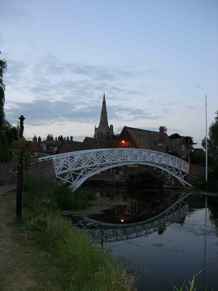
Photo: Wikimedia, Public domain.
Godmanchester is a town and civil parish in the Huntingdonshire district of Cambridgeshire, England. It is separated from Huntingdon, 1 mile to the north, by the valley of the River Great Ouse.
Teddy’s Lake
Latitude
52.32932° or 52° 19′ 46″ northLongitude
-0.14851° or 0° 8′ 55″ westOpen location code
9C4X8VH2+PHOpenStreetMap ID
way 91991923OpenStreetMap feature
natural=water
This page is based on OpenStreetMap, Wikidata, and Wikimedia Commons.
We’d love your help improving our open data sources. Thank you for contributing.
Satellite Map
Discover Teddy’s Lake from above in high-definition satellite imagery.
Notable Places Nearby
Highlights include Lake 8 and Woolpack Fisheries.
Nearby Places
Explore places such as Hide and Wigeon Pond.
England: Must-Visit Destinations
Delve into London, Manchester, Sheffield, and Leeds.
Curious Places to Discover
Uncover intriguing places from every corner of the globe.
About Mapcarta. Data © OpenStreetMap contributors and available under the Open Database License". Text is available under the CC BY-SA 4.0 license, except for photos, directions, and the map. Photo: sidibousaid, CC BY 2.0.