Poste Marnach
Poste Marnach is an electrical substation in Clervaux, Éislek. Poste Marnach is situated nearby to the forest Huuscht, as well as near the shopping center Nordstrooss Shopping Mile Marnach.| Tap on a place to explore it |
Places of Interest Nearby
Highlights include Église Saint-Luc and Cube 521.
Église Saint-Luc
Church
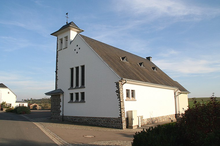
Photo: Cornischong, CC BY-SA 3.0.
Église Saint-Luc is a church, which is situated 1 km south of Poste Marnach.
Cube 521
Community center
 Cube 521 is a community center, which is situated 1½ km northwest of Poste Marnach.
Église Saint-Joseph
Church
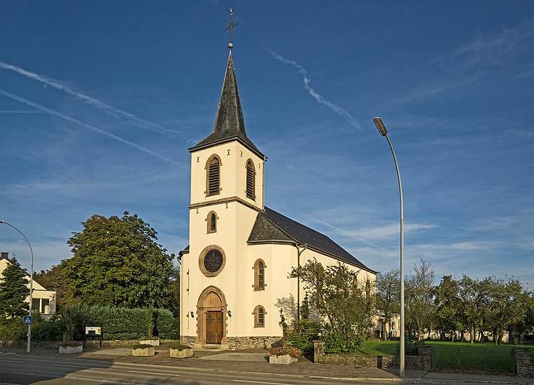
Photo: MMFE, CC BY-SA 3.0.
Église Saint-Joseph is a church, which is situated 1½ km northwest of Poste Marnach.
Places in the Area
Nearby places include Dorscheid and Roder.

Roder
Village

Photo: David Edgar, CC BY 2.5.
Roder is a village in the commune of Munshausen, in northern Luxembourg. As of 2023, the village has a population of 77.
Marnach
Village

Photo: David Edgar, CC BY 2.5.
Marnach is a small town in the commune of Clerf, in northern Luxembourg. As of 2025, the town has a population of 782. Near Marnach is the site of the transmitter of Radio Luxembourg.
Poste Marnach
- Type: Electrical substation
- Category: industry
- Location: Clervaux, Clervaux, Éislek, Luxembourg, Benelux, Europe
- View on OpenStreetMap
Latitude
50.04427° or 50° 2′ 39″ northLongitude
6.07608° or 6° 4′ 34″ eastOperator
CreosOpen location code
9F2823VG+PCOpenStreetMap ID
way 92058484
This page is based on OpenStreetMap, Wikidata, and Wikimedia Commons.
We’d love your help improving our open data sources. Thank you for contributing.
Satellite Map
Discover Poste Marnach from above in high-definition satellite imagery.
Notable Places Nearby
Highlights include Huuscht and Nordstrooss Shopping Mile Marnach.
Nearby Places
Explore places such as Schwaarzenhiwwel and Marnach, Beim Sender.
Éislek: Must-Visit Destinations
Delve into Ettelbruck, Diekirch, Vianden, and Wiltz.
Curious Electrical Substations to Discover
Uncover intriguing electrical substations from every corner of the globe.
About Mapcarta. Data © OpenStreetMap contributors and available under the Open Database License". Text is available under the CC BY-SA 4.0 license, except for photos, directions, and the map. Photo: Ymblanter, CC BY-SA 3.0.