Wielerparcours Kalverdijkje
Wielerparcours Kalverdijkje is an athletics track in Leeuwarden, Friesland. Wielerparcours Kalverdijkje is situated nearby to the sports venue Sportvelden Kalverdijkje Zuid, as well as near V.V. Nicator.| Tap on a place to explore it |
Places of Interest Nearby
Highlights include Cambuur Stadion and De Schakel.
Cambuur Stadion

Photo: stefanoost, CC BY 2.0.
The Cambuur Stadion is a football stadium in the east side of the city of Leeuwarden, Netherlands. It was used for the home matches of SC Cambuur. The stadium is able to hold 10,500 people and it opened on 12 September 1936. Cambuur Stadion is situated 1 km west of Wielerparcours Kalverdijkje.
De Schakel
Church

Photo: RomkeHoekstra, CC BY-SA 4.0.
De Schakel is a church, which is situated 640 metres northeast of Wielerparcours Kalverdijkje.
Dr. Zamenhofpark
Park

Photo: Ytzen, CC BY-SA 3.0.
Dr. Zamenhofpark is situated 1 km west of Wielerparcours Kalverdijkje.
Places in the Area
Nearby places include Snakkerburen and Lekkum.
Snakkerburen
Village

Photo: Jan dijkstra, CC BY-SA 4.0.
Snakkerburen is a village in Leeuwarden municipality in the province of Friesland, the Netherlands. It had a population of around 225 in January 2017.
Lekkum
Village
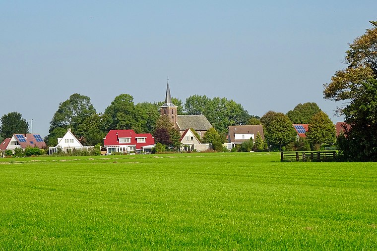
Photo: Gouwenaar, CC BY-SA 4.0.
Lekkum is a village in Leeuwarden municipality in the Friesland province of the Netherlands. It had a population of around 405 in January 2017. De Bullemolen in Lekkum marks the finishing point of the Elfstedentocht.
Hempens
Village

Photo: Bouwe Brouwer, CC BY-SA 3.0.
Hempens is a village in Leeuwarden municipality in the province of Friesland, the Netherlands. It was first mentioned in 1463 as Hempens, and means "settlement of the people of Hempe ". Hempens is situated 3 km south of Wielerparcours Kalverdijkje.
Wielerparcours Kalverdijkje
- Type: Athletics track
- Categories: recreation area, cycle sport, and sports location
- Location: Leeuwarden, Friesland, Northern Netherlands, Netherlands, Benelux, Europe
- View on OpenStreetMap
Latitude
53.20699° or 53° 12′ 25″ northLongitude
5.82923° or 5° 49′ 45″ eastOpen location code
9F576R4H+QMOpenStreetMap ID
way 92840996OpenStreetMap feature
leisure=trackOpenStreetMap feature
sport=cycling
This page is based on OpenStreetMap, Wikidata, and Wikimedia Commons.
We’d love your help improving our open data sources. Thank you for contributing.
Satellite Map
Discover Wielerparcours Kalverdijkje from above in high-definition satellite imagery.
Notable Places Nearby
Highlights include Sportvelden Kalverdijkje Zuid and Mixed Hockey Club Leeuwarden.
Nearby Places
Explore places such as Scholengemeenschap Comenius and Dierenopvang de Wissel.
Friesland: Must-Visit Destinations
Delve into Heerenveen, Sneek, Harlingen, and De Fryske Marren.
Curious Athletics Tracks to Discover
Uncover intriguing athletics tracks from every corner of the globe.
About Mapcarta. Data © OpenStreetMap contributors and available under the Open Database License". Text is available under the CC BY-SA 4.0 license, except for photos, directions, and the map. Photo: Ymblanter, CC BY-SA 4.0.