Haus Velde
Haus Velde is a farmhouse in Krefeld, Düsseldorf, North Rhine-Westphalia. Haus Velde is situated nearby to the nature reserve Der breite Eschel, as well as near the town Kempen.| Tap on a place to explore it |
Places of Interest Nearby
Highlights include Der breite Eschel and Burg Kempen.
Der breite Eschel
Nature reserve

Photo: Rudolfo42, CC BY-SA 4.0.
Der breite Eschel is a nature reserve.
Burg Kempen
Castle

Photo: Alexostrov, CC BY-SA 3.0.
Burg Kempen is a castle, which is situated 3½ km southeast of Haus Velde.
Kempen station
Railway station
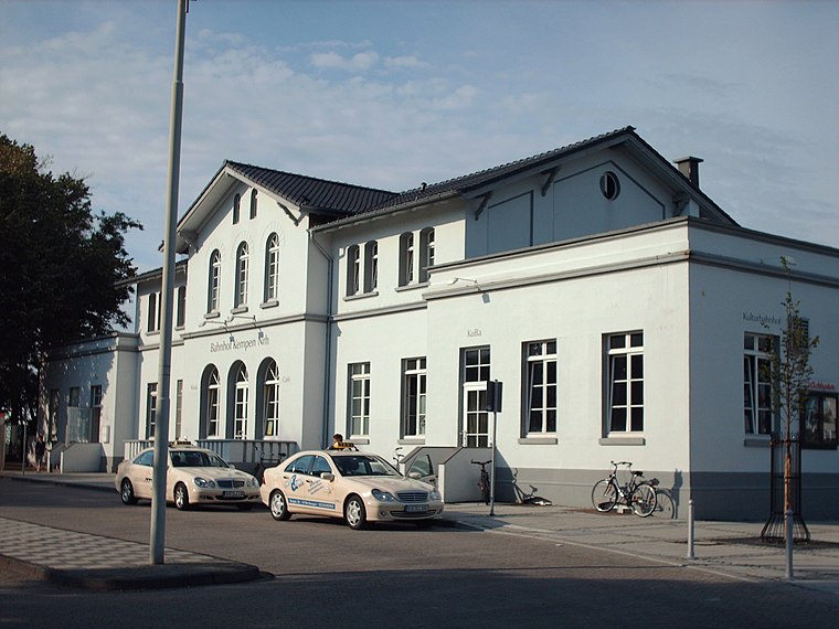
Photo: Stefan Flöper, CC BY-SA 4.0.
Kempen station is a railway station, which is situated 3½ km southeast of Haus Velde.
Places in the Area
Nearby places include Kempen and Wachtendonk.
Kempen
Town

Photo: O.Falkner, CC BY-SA 3.0.
Kempen is a town in the district of Viersen, in North Rhine-Westphalia, Germany. It is situated approximately 30 kilometres northwest of Düsseldorf, and 20 kilometres east of Venlo. Kempen is situated 3½ km southeast of Haus Velde.
Wachtendonk
Village

Photo: Palickap, CC BY-SA 3.0.
Wachtendonk at the confluence of Niers River and Nette River is a municipality in the district of Kleve in North Rhine-Westphalia, Germany. It is located west of the Rhine halfway between Duisburg and Venlo at the Dutch border. Its name means 'bailiff's Donk'. Wachtendonk is situated 5 km west of Haus Velde.
Aldekerk
Village

Photo: Wikimedia, CC BY-SA 4.0.
Aldekerk is a village and a part of the municipality of Kerken in Kleve, which is part of the Düsseldorf administrative region. in the state of North Rhine-Westphalia, Germany. Aldekerk is situated 5 km north of Haus Velde.
Haus Velde
- Type: Farmhouse
- Categories: building, historic site, historic building, and agriculture
- Location: Krefeld, Düsseldorf, Lower Rhine, North Rhine-Westphalia, Germany, Central Europe, Europe
- View on OpenStreetMap
Latitude
51.39296° or 51° 23′ 35″ northLongitude
6.40021° or 6° 24′ 1″ eastInception
1577Open location code
9F389CV2+53OpenStreetMap ID
way 930202682OpenStreetMap feature
building=farmOpenStreetMap feature
historic=building
This page is based on OpenStreetMap, Wikidata, and Wikimedia Commons.
We’d love your help improving our open data sources. Thank you for contributing.
Satellite Map
Discover Haus Velde from above in high-definition satellite imagery.
Notable Places Nearby
Highlights include S.C. Tell Schmalbroich 1932 e.V and HSC Kempen und Umgebung e.V..
Nearby Places
Explore places such as Haus Feld and Station 5 ‘Haus Velde’.
Lower Rhine: Must-Visit Destinations
Delve into Düsseldorf, Mönchengladbach, Neuss, and Kleve.
Curious Farmhouses to Discover
Uncover intriguing farmhouses from every corner of the globe.
About Mapcarta. Data © OpenStreetMap contributors and available under the Open Database License". Text is available under the CC BY-SA 4.0 license, except for photos, directions, and the map. Photo: Carschten, CC BY-SA 4.0.