Hafenspitze
Hafenspitze is a hotel building in Düsseldorf, Lower Rhine, North Rhine-Westphalia which is located on Speditionstraße. Hafenspitze is situated nearby to the hotel Hyatt Regency Dusseldorf, as well as near the warehouse Roggendorf-Haus.| Tap on a place to explore it |
Places of Interest Nearby
Highlights include Hyatt Regency Dusseldorf and Colorium.
Hyatt Regency Dusseldorf
Hotel

Photo: Martin Kraft, CC BY-SA 3.0.
Hyatt Regency Dusseldorf is a hotel.

The Living Bridge
Bridge

Photo: Wikimedia, CC BY-SA 3.0.
The Living Bridge is situated 140 metres southeast of Hafenspitze.
Places in the Area
Nearby places include Unterbilk and Düsseldorf-Oberkassel.
Unterbilk
Suburb
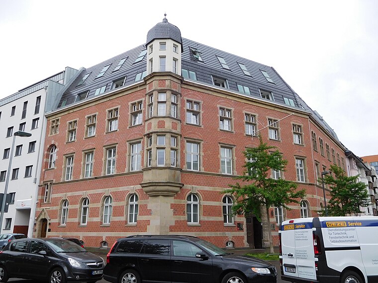
Photo: JiriMatejicek, CC BY-SA 4.0.
Unterbilk is an urban quarter in Borough 3 of the North Rhine-Westphalia state capital Düsseldorf. It is the seat of the Landtag of North Rhine-Westphalia, the Rheinturm tower and, together with the Düsseldorf docks is the centre of the media industry in Düsseldorf.
Düsseldorf-Oberkassel
Suburb
Oberkassel is a part of Düsseldorf's Borough 4. Oberkassel lies on the west side of the river Rhine, the opposite side of the central district of Düsseldorf.
Düsseldorf-Carlstadt
Suburb

Photo: Pixelcrew, CC BY-SA 3.0.
Carlstadt is a quarter of Düsseldorf and belongs to the central Borough 1. It lies south of the Old Town and was named after the Duke Carl-Theodor, who founded this borough.
Hafenspitze
- Type: Hotel building
- Address: Speditionstraße 21, Düsseldorf, 40221
- Categories: building, accommodation, and tourism
- Location: Düsseldorf, Düsseldorf, Lower Rhine, North Rhine-Westphalia, Germany, Central Europe, Europe
- View on OpenStreetMap
Latitude
51.21677° or 51° 13′ 0″ northLongitude
6.75222° or 6° 45′ 8″ eastLevels
20Open location code
9F386Q82+PVOpenStreetMap ID
way 93227906OpenStreetMap feature
building=hotel
This page is based on OpenStreetMap, Wikidata, and Wikimedia Commons.
We’d love your help improving our open data sources. Thank you for contributing.
Satellite Map
Discover Hafenspitze from above in high-definition satellite imagery.
Places with the Same Name
Discover other places named “Hafenspitze”.
Notable Places Nearby
Highlights include Roggendorf-Haus and KAI 10 Arthena Foundation.
Nearby Places
Explore places such as Bain & Company and Citizenoffice.
Lower Rhine: Must-Visit Destinations
Delve into Mönchengladbach, Krefeld, Neuss, and Kleve.
Curious Places to Discover
Uncover intriguing places from every corner of the globe.
About Mapcarta. Data © OpenStreetMap contributors and available under the Open Database License". Text is available under the CC BY-SA 4.0 license, except for photos, directions, and the map. Photo: Steff, CC BY-SA 3.0.