Pumpwerk Garatshausen
Pumpwerk Garatshausen is a pumping station in Tutzing, Starnberg, Bavaria. Pumpwerk Garatshausen is situated nearby to the castle Schloß Garatshausen, as well as near the swimming area Freibad Garatshausen.| Tap on a place to explore it |
Places of Interest Nearby
Highlights include Rose Island and Villa Waldberta.
Rose Island
Islet
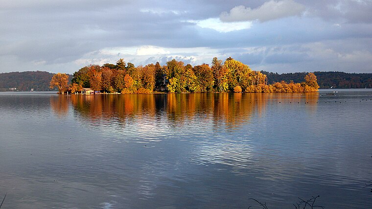
Photo: Reinraum, Public domain.
Rose Island in Lake Starnberg is the only island in the lake and the site of a royal villa of Ludwig II of Bavaria which had been commissioned by his father.
Villa Waldberta
Building

Photo: Godewind, CC BY-SA 2.0 de.
Villa Waldberta Artists Residence is a historic estate in Feldafing, Bavaria, Germany. The villa, along with Ebenböckhaus in Pasing, accommodates the city of Munich's Artist-in-Residence program. Villa Waldberta was completed in 1902 in the historicist style. Villa Waldberta is situated 2 km north of Pumpwerk Garatshausen.
Villa Carl (Feldafing)
House

Photo: I. Berger, CC BY-SA 3.0.
Villa Carl (Feldafing) is a house, which is situated 2 km north of Pumpwerk Garatshausen.
Places in the Area
Nearby places include Feldafing and Traubing.
Feldafing
Village
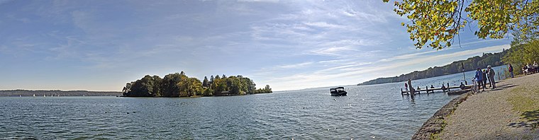
Photo: Guido Radig, CC BY 3.0.
Feldafing is a municipality in Starnberg district, Bavaria, Germany, and is located on the west shore of Lake Starnberg, southwest of Munich.
Traubing
Village

Photo: I. Berger, CC BY-SA 3.0.
Traubing is a village, which is situated 3½ km northwest of Pumpwerk Garatshausen.
Ammerland (Münsing)
Village

Photo: Chaos, CC BY-SA 3.0.
Ammerland (Münsing) is a village, which is situated 4 km southeast of Pumpwerk Garatshausen.
Pumpwerk Garatshausen
- Type: Pumping station
- Categories: building and industry
- Location: Tutzing, Starnberg, Upper Bavaria, Bavaria, Germany, Central Europe, Europe
- View on OpenStreetMap
Latitude
47.92646° or 47° 55′ 35″ northLongitude
11.29552° or 11° 17′ 44″ eastOperator
Abwasserverband Starnberger SeeOpen location code
8FVHW7GW+H6OpenStreetMap ID
way 935877755OpenStreetMap feature
building=yesOpenStreetMap feature
man_made=pumping_station
This page is based on OpenStreetMap, Wikidata, and Wikimedia Commons.
We’d love your help improving our open data sources. Thank you for contributing.
Satellite Map
Discover Pumpwerk Garatshausen from above in high-definition satellite imagery.
Notable Places Nearby
Highlights include Schloß Garatshausen and Freibad Garatshausen.
Nearby Places
Explore places such as Eishockeyweiher and Park Feldafing und Roseninsel.
Upper Bavaria: Must-Visit Destinations
Delve into Munich, Ingolstadt, Dachau, and Rosenheim.
Curious Pumping Stations to Discover
Uncover intriguing pumping stations from every corner of the globe.
About Mapcarta. Data © OpenStreetMap contributors and available under the Open Database License". Text is available under the CC BY-SA 4.0 license, except for photos, directions, and the map. Photo: Aconcagua, CC BY-SA 3.0.