Thornton Grange
Thornton Grange is a farm in Thornton-le-Clay, Ryedale District, England. Thornton Grange is situated nearby to the village Flaxton, as well as near the hamlet Barton Hill.| Tap on a place to explore it |
Places of Interest Nearby
Highlights include Sheriff Hutton Castle and St Lawrence’s Church, Flaxton.
Sheriff Hutton Castle
Castle
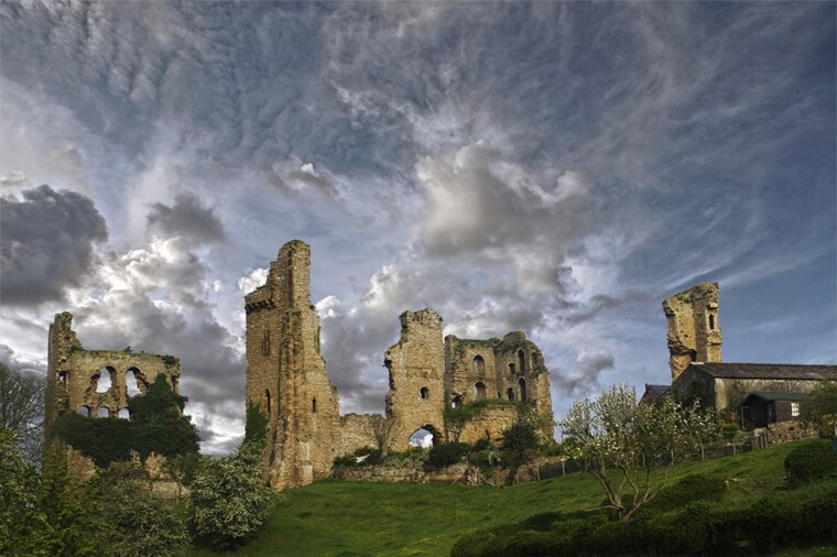
Photo: Shaunconway, CC BY 3.0.
Sheriff Hutton Castle is a ruined quadrangular castle in the village of Sheriff Hutton, North Yorkshire, England. The site of the castle is 10 miles north of York, and 8 miles south-east of Easingwold. Sheriff Hutton Castle is situated 1½ miles northwest of Thornton Grange.
St Lawrence’s Church, Flaxton
Church
St Lawrence's Church is an Anglican church in Flaxton, North Yorkshire, a village in England. Until the mid 19th century, Flaxton was divided between the parishes of St Botolph's Church, Bossall and All Saints' Church, Foston. St Lawrence’s Church, Flaxton is situated 1½ miles south of Thornton Grange.
Church of St Helen and the Holy Cross
Church

Photo: Shaunconway, CC BY 3.0.
Church of St Helen and the Holy Cross is situated 1½ miles northwest of Thornton Grange.
Places in the Area
Nearby places include Flaxton and Barton Hill.
Flaxton
Village

Photo: Gordon Kneale Brooke, CC BY-SA 2.0.
Flaxton is a small village and civil parish in North Yorkshire, England. It is close to the A64 between York and Malton. The village lies entirely within a Conservation Area as defined by Planning 1990.
Barton Hill
Hamlet

Photo: Barbara Carr, CC BY-SA 2.0.
Barton Hill is a village in North Yorkshire, off the A64 road, near Barton-le-Willows. From 1974 to 2023 it was part of the district of Ryedale, it is now administered by the unitary North Yorkshire Council. Barton Hill is situated 2 miles east of Thornton Grange.
Harton
Village
Harton is a village and civil parish in North Yorkshire, England. The population of the civil parish was less than 99 at the 2021 Census. However, in 2015, North Yorkshire County Council estimated the population to be 80. Harton is situated 2½ miles southeast of Thornton Grange.
Thornton Grange
- Type: Farm
- Category: agriculture
- Location: Thornton-le-Clay, Ryedale District, North Yorkshire, Yorkshire, England, United Kingdom, Britain and Ireland, Europe
- View on OpenStreetMap
Latitude
54.07171° or 54° 4′ 18″ northLongitude
-0.97305° or 0° 58′ 23″ westOpen location code
9C6X32CG+MQOpenStreetMap ID
way 938351761OpenStreetMap feature
landuse=farmyard
This page is based on OpenStreetMap, Wikidata, and Wikimedia Commons.
We’d love your help improving our open data sources. Thank you for contributing.
Satellite Map
Discover Thornton Grange from above in high-definition satellite imagery.
Places with the Same Name
Discover other places named “Thornton Grange”.
Notable Places Nearby
Highlights include East Lilling and Thornton-le-Clay Methodist Church.
Nearby Places
Explore places such as Thornton Cottage Farm and Thompsons Arms.
North Yorkshire: Must-Visit Destinations
Delve into York, Middlesbrough, Harrogate, and Ripon.
Curious Farms to Discover
Uncover intriguing farms from every corner of the globe.
About Mapcarta. Data © OpenStreetMap contributors and available under the Open Database License". Text is available under the CC BY-SA 4.0 license, except for photos, directions, and the map. Photo: Michael Bryan, CC BY 2.0.