Centre d’Acolliment d’infants
Centre d’Acolliment d’infants is a public building in Badalona, Barcelona, Catalonia. Centre d’Acolliment d’infants is situated nearby to the garden Jardí romàntic, as well as near Glorieta de las palmeras.| Tap on a place to explore it |
Places of Interest Nearby
Highlights include Parc de Can Solei i Ca l’Arnús and Escola Artur Martorell.
Parc de Can Solei i Ca l’Arnús
Park

Photo: Judesba, CC BY-SA 3.0.
Parc de Can Solei i Ca l’Arnús is a park, which is situated 140 metres northeast of Centre d’Acolliment d’infants.

Badalona Museum
Museum
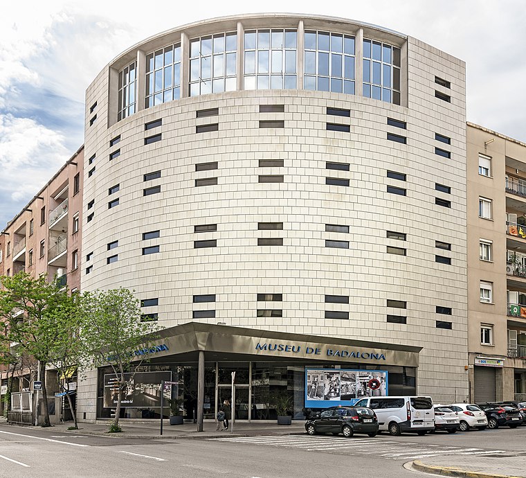
Photo: Archaeodontosaurus, CC BY-SA 4.0.
The Badalona Museum, opened in 1966, hosts the remains of the Roman city of Baetulo. The remains include Roman baths, shops, housing complexes, and part of the cardo maximus and decumanus maximus. Badalona Museum is situated 530 metres southwest of Centre d’Acolliment d’infants.
Places in the Area
Nearby places include Casagemes and Canyadó.


Centre
Neighborhood

Photo: Archaeodontosaurus, CC BY-SA 4.0.
Centre is the usual name for the central area of Badalona, a locality in the metropolitan area of Barcelona. It is located in the District 1 by the Mediterranean Sea, and is a commercial and residential area with good transportation connections.
Centre d’Acolliment d’infants
- Type: Public building
- Categories: building and government building
- Location: Badalona, Barcelona, Catalonia, Eastern Spain, Spain, Iberia, Europe
- View on OpenStreetMap
Latitude
41.45557° or 41° 27′ 20″ northLongitude
2.25216° or 2° 15′ 8″ eastLevels
4Open location code
8FH4F742+6VOpenStreetMap ID
way 93906955OpenStreetMap feature
building=public
This page is based on OpenStreetMap, Wikidata, and Wikimedia Commons.
We’d love your help improving our open data sources. Thank you for contributing.
Satellite Map
Discover Centre d’Acolliment d’infants from above in high-definition satellite imagery.
Notable Places Nearby
Highlights include Jardí romàntic and Plaça de les palmeres.
Nearby Places
Explore places such as Casa de Coma Cros and AVV Can Solei.
Barcelona: Must-Visit Destinations
Delve into Barcelona, Malgrat de Mar, Terrassa, and L’Hospitalet de Llobregat.
Curious Public Buildings to Discover
Uncover intriguing public buildings from every corner of the globe.
About Mapcarta. Data © OpenStreetMap contributors and available under the Open Database License". Text is available under the CC BY-SA 4.0 license, except for photos, directions, and the map. Photo: Pere prlpz, CC BY-SA 3.0.