Chapelle-Notre Dame de Bon Secours
Chapelle-Notre Dame de Bon Secours is a church in Genappe, Arrondissement of Nivelles, Wallonia. Chapelle-Notre Dame de Bon Secours is situated nearby to the church Grotte Notre-Dame de Lourdes, as well as near Chapelle Notre-Dame des Affligés de Ways.| Tap on a place to explore it |
Places of Interest Nearby
Highlights include Auberge du Roy d’Espagne and Église Saint-Barthélemy de Bousval.
Auberge du Roy d’Espagne
House
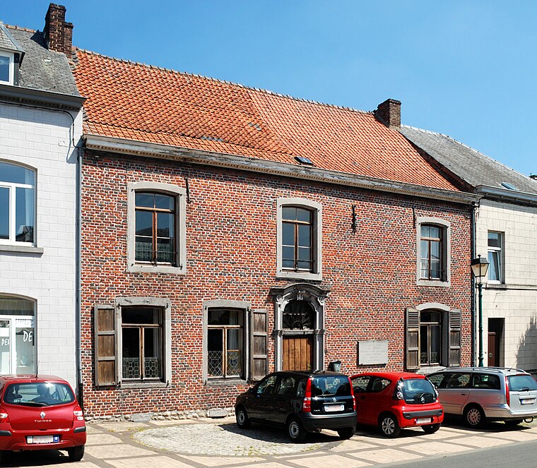
Photo: EmDee, CC BY-SA 3.0.
Auberge du Roy d’Espagne is a house, which is situated 1¼ km west of Chapelle-Notre Dame de Bon Secours.
Église Saint-Barthélemy de Bousval
Church

Photo: EmDee, CC BY-SA 4.0.
Église Saint-Barthélemy de Bousval is a church, which is situated 3 km east of Chapelle-Notre Dame de Bon Secours.
Chapel of Try-au-Chêne
Church

Photo: EmDee, CC BY-SA 3.0.
Chapel of Try-au-Chêne is a church, which is situated 3½ km east of Chapelle-Notre Dame de Bon Secours.
Places in the Area
Nearby places include Quatre Bras and Houtain-le-Val.
Quatre Bras
Hamlet
Quatre Bras is a hamlet in the municipality of Genappe, Wallonia, Belgium. It lies on the crossroad of the Charleroi–Brussels road and the Nivelles–Namur road south of Genappe. Quatre Bras is situated 5 km south of Chapelle-Notre Dame de Bon Secours.
Houtain-le-Val
Village

Photo: flamenc, CC BY-SA 3.0.
Houtain-le-Val is a village, which is situated 5 km southwest of Chapelle-Notre Dame de Bon Secours.
Sart-Messire-Guillaume
Village

Photo: EmDee, CC BY-SA 3.0.
Sart-Messire-Guillaume is a village, which is situated 7 km east of Chapelle-Notre Dame de Bon Secours.
Chapelle-Notre Dame de Bon Secours
- Type: Church
- Categories: building, chapel, historic site, place of worship, and religion
- Location: Genappe, Arrondissement of Nivelles, Walloon Brabant, Wallonia, Belgium, Benelux, Europe
- View on OpenStreetMap
Latitude
50.61365° or 50° 36′ 49″ northLongitude
4.4677° or 4° 28′ 4″ eastInception
1856Open location code
9F26JF79+F3OpenStreetMap ID
way 941733344OpenStreetMap feature
amenity=place_of_worshipOpenStreetMap feature
building=chapelOpenStreetMap feature
historic=yes
This page is based on OpenStreetMap, Wikidata, and Wikimedia Commons.
We’d love your help improving our open data sources. Thank you for contributing.
Satellite Map
Discover Chapelle-Notre Dame de Bon Secours from above in high-definition satellite imagery.
Places with the Same Name
Discover other places named “Chapelle-Notre Dame de Bon Secours”.
Notable Places Nearby
Highlights include Grotte Notre-Dame de Lourdes and Chapelle Notre-Dame des Affligés de Ways.
Nearby Places
Explore places such as École Communale de Ways and Ferme de la Marnière.
Walloon Brabant: Must-Visit Destinations
Delve into Waterloo, Villers-la-Ville, and Louvain-la-Neuve.
Curious Churches to Discover
Uncover intriguing churches from every corner of the globe.
About Mapcarta. Data © OpenStreetMap contributors and available under the Open Database License". Text is available under the CC BY-SA 4.0 license, except for photos, directions, and the map. Photo: Wikimedia, CC BY-SA 3.0.