Wasserkraftwerk Cramberg
Wasserkraftwerk Cramberg is a power station in Steinsberg, Rhein-Lahn-Kreis, Rhineland-Palatinate. Wasserkraftwerk Cramberg is situated nearby to the scenic viewpoint Gabelstein, as well as near the peak Bocken.| Tap on a place to explore it |
Places of Interest Nearby
Highlights include Gabelstein-Hoelloch and Schaumburg Castle.
Gabelstein-Hoelloch
Nature reserve

Photo: Christa1111, CC BY-SA 4.0.
Gabelstein-Hoelloch is a nature reserve.
Schaumburg Castle
Castle

Photo: Carsten Steger, CC BY-SA 4.0.
Schaumburg Castle is a schloss in Rhineland-Palatinate, Germany, south of Balduinstein near Limburg an der Lahn. It was owned by the former ruling family of Waldeck and Pyrmont, and it served as the retirement residence of SS General Josias, Hereditary Prince of Waldeck and Pyrmont. Schaumburg Castle is situated 2 km east of Wasserkraftwerk Cramberg.
Castle Balduinstein
Castle
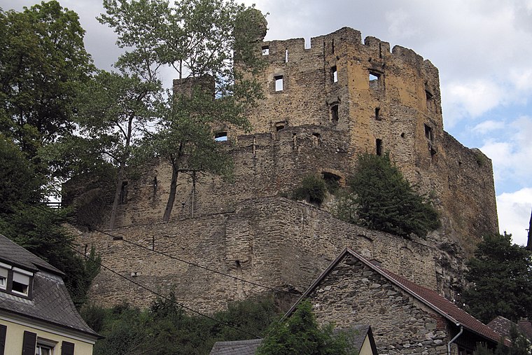
Photo: Wikimedia, CC BY-SA 2.0 de.
Castle Balduinstein is situated 2 km northeast of Wasserkraftwerk Cramberg.
Places in the Area
Nearby places include Cramberg and Balduinstein.
Cramberg
Village

Photo: Haneburger, CC0.
Cramberg is a municipality in the Nassau Nature Park in the district of Rhein-Lahn, in Rhineland-Palatinate, in western Germany. It belongs to the association community of Diez.
Balduinstein
Village

Photo: Whgler, CC BY-SA 4.0.
Balduinstein is a municipality in the district of Rhein-Lahn, in Rhineland-Palatinate, in western Germany. It belongs to the association community of Diez.
Langenscheid
Village

Photo: LigaDue, CC BY-SA 4.0.
Langenscheid is a municipality in the district of Rhein-Lahn, in Rhineland-Palatinate, in western Germany. It belongs to the association community of Diez.
Wasserkraftwerk Cramberg
- Type: Power station
- Category: industry
- Location: Steinsberg, Rhein-Lahn-Kreis, Rhineland-Palatinate, Germany, Central Europe, Europe
- View on OpenStreetMap
Latitude
50.33722° or 50° 20′ 14″ northLongitude
7.95023° or 7° 57′ 1″ eastInception
1927Operator
Süwag Energie AGOpen location code
9F298XP2+V3OpenStreetMap ID
way 94582822
This page is based on OpenStreetMap, Wikidata, and Wikimedia Commons.
We’d love your help improving our open data sources. Thank you for contributing.
Satellite Map
Discover Wasserkraftwerk Cramberg from above in high-definition satellite imagery.
Notable Places Nearby
Highlights include Gabelstein and Bocken.
Nearby Places
Explore places such as Wanderparkplatz Cramberg and Gabelstein.
Rhineland-Palatinate: Must-Visit Destinations
Delve into Mainz, Trier, Koblenz, and Worms.
Curious Power Stations to Discover
Uncover intriguing power stations from every corner of the globe.
About Mapcarta. Data © OpenStreetMap contributors and available under the Open Database License". Text is available under the CC BY-SA 4.0 license, except for photos, directions, and the map. Photo: Traveler100, CC BY-SA 3.0.