(Woodpecker Farm)
(Woodpecker Farm) is a building in Hillingdon, Greater London, England. (Woodpecker Farm) is situated nearby to the grassland St George’s Meadows, as well as near the arts center Southlands Arts Centre.| Tap on a place to explore it |
Places of Interest Nearby
Highlights include Southlands and St Catherine’s Church, West Drayton.
Southlands
Building

Photo: Jones44444, CC BY-SA 4.0.
Southlands is a building, which is situated 610 feet north of (Woodpecker Farm).
St Catherine’s Church, West Drayton
Church

Photo: Doyle of London, CC BY-SA 4.0.
St Catherine's Church or St Catherine of Alexandria Church is a Catholic parish church in West Drayton, Borough of Hillingdon, London. It was built from 1868 to 1869 and designed by Thomas John Willson and Samuel Joseph Nicholl. St Catherine’s Church, West Drayton is situated 1,600 feet north of (Woodpecker Farm).
West Drayton railway station
Railway station
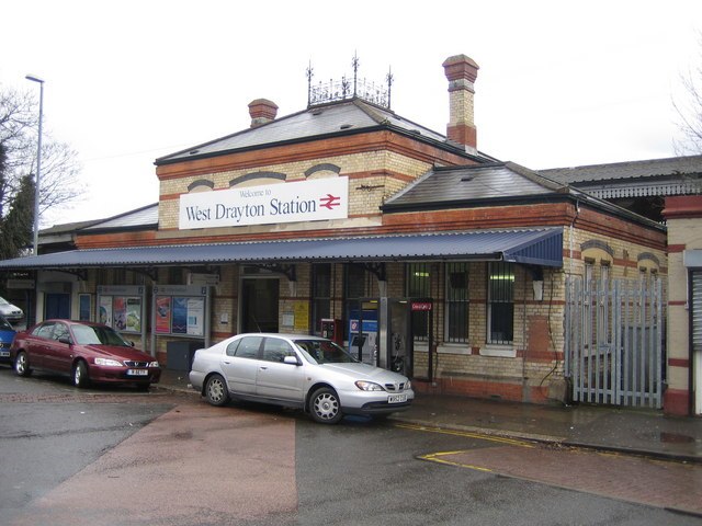
Photo: Nigel Cox, CC BY-SA 2.0.
West Drayton railway station serves West Drayton and Yiewsley, western suburbs of London. It is served and managed by the Elizabeth line. It is 13 miles 71 chains down the line from London Paddington and is situated between Hayes & Harlington to the east and Iver to the west. West Drayton railway station is situated 3,700 feet north of (Woodpecker Farm).
Places in the Area
Nearby places include West Drayton and Thorney.
West Drayton
Suburb

Photo: Rod Allday, CC BY-SA 2.0.
West Drayton is a suburban town in the London Borough of Hillingdon. It was an ancient parish in the county of Middlesex and from 1929 was part of the Yiewsley and West Drayton Urban District, which became part of Greater London in 1965.
Thorney
Village

Photo: Rod Allday, CC BY-SA 2.0.
Iver is a civil parish in Buckinghamshire, England. In addition to the central clustered village, the parish includes the residential neighbourhoods of Iver Heath and Richings Park and the hamlets of Shreding Green and Thorney.
Harmondsworth
Suburb

Photo: Ray Stanton, CC BY-SA 2.0.
Harmondsworth is a village in the London Borough of Hillingdon in the county of Greater London with a short border to the south onto London Heathrow Airport and close to the Berkshire county border.
(Woodpecker Farm)
- Type: Building
- Location: Hillingdon, Greater London, England, United Kingdom, Britain and Ireland, Europe
- View on OpenStreetMap
Latitude
51.49999° or 51° 29′ 60″ northLongitude
-0.47673° or 0° 28′ 36″ westOpen location code
9C3XFGXF+X8OpenStreetMap ID
way 955380326OpenStreetMap feature
building=yes
This page is based on OpenStreetMap, Wikidata, and Wikimedia Commons.
We’d love your help improving our open data sources. Thank you for contributing.
Satellite Map
Discover (Woodpecker Farm) from above in high-definition satellite imagery.
Places with the Same Name
Discover other places named “(Woodpecker Farm)”.
Notable Places Nearby
Highlights include St George’s Meadows and Southlands Arts Centre.
Nearby Places
Explore places such as The Mead Cottage and Roseary Close.
England: Must-Visit Destinations
Delve into London, Manchester, Sheffield, and Leeds.
Curious Buildings to Discover
Uncover intriguing buildings from every corner of the globe.
About Mapcarta. Data © OpenStreetMap contributors and available under the Open Database License". Text is available under the CC BY-SA 4.0 license, except for photos, directions, and the map. Photo: sidibousaid, CC BY 2.0.