Chillington Farm
Chillington Farm is a house in Brewood and Coven, South Staffordshire District, England. Chillington Farm is situated nearby to Walled Garden, as well as near the forest Robinson’s Plantation.| Tap on a place to explore it |
Places of Interest Nearby
Highlights include Chillington Hall and Royal Oak.
Chillington Hall
Manor estate

Photo: Row17, CC BY-SA 2.0.
Chillington Hall is a Georgian country house near Brewood, Staffordshire, England, four miles northwest of Wolverhampton. It is the residence of the Giffard family. Chillington Hall is situated 2,100 feet southeast of Chillington Farm.
Royal Oak

Photo: Sjwells53, CC BY-SA 3.0.
The Royal Oak was the English oak tree within which the future King Charles II of England hid to escape the Roundheads following the Battle of Worcester in 1651. Royal Oak is situated 1½ miles west of Chillington Farm.
Boscobel House

Photo: Rob Farrow, CC BY-SA 2.0.
Boscobel House is a Grade II* listed building in the parish of Boscobel in Shropshire. It has been, at various times, a farmhouse, a hunting lodge, and a holiday home; but it is most famous for its role in the escape of Charles II after the Battle of Worcester in 1651. Boscobel House is situated 1½ miles west of Chillington Farm.
Places in the Area
Nearby places include Boscobel and Brewood.
Boscobel
Hamlet
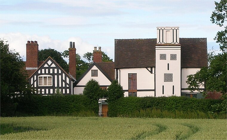
Photo: Oosoom, CC BY-SA 3.0.
Boscobel is a civil parish in the east of Shropshire, England, on the border with Staffordshire. To the north is the Staffordshire village of Bishops Wood. Boscobel is situated 1½ miles west of Chillington Farm.
Brewood
Village

Photo: Oosoom, CC BY-SA 3.0.
Brewood is an ancient market town in the civil parish of Brewood and Coven, in the South Staffordshire district, in the county of Staffordshire, England. Brewood is situated 2 miles northeast of Chillington Farm.
Bishops Wood
Village
Bishops Wood, or Bishopswood is a small village on the Staffordshire border with Shropshire. It is home to the Royal Oak public house, the first to be named after the nearby oak tree at Boscobel House in which King Charles II hid after the Battle of Worcester. Bishops Wood is situated 2 miles northwest of Chillington Farm.
Chillington Farm
- Type: House
- Categories: building and residential building
- Location: Brewood and Coven, South Staffordshire District, Staffordshire, West Midlands, England, United Kingdom, Britain and Ireland, Europe
- View on OpenStreetMap
Latitude
52.66384° or 52° 39′ 50″ northLongitude
-2.20725° or 2° 12′ 26″ westOpen location code
9C4VMQ7V+G3OpenStreetMap ID
way 956020493OpenStreetMap feature
building=house
This page is based on OpenStreetMap, Wikidata, and Wikimedia Commons.
We’d love your help improving our open data sources. Thank you for contributing.
Satellite Map
Discover Chillington Farm from above in high-definition satellite imagery.
Notable Places Nearby
Highlights include Walled Garden and Robinson’s Plantation.
Nearby Places
Explore places such as Chillington Farm and Chillington Hall Cottages.
Staffordshire: Must-Visit Destinations
Delve into Stoke-on-Trent, Lichfield, Stafford, and Tamworth.
Curious Houses to Discover
Uncover intriguing houses from every corner of the globe.
About Mapcarta. Data © OpenStreetMap contributors and available under the Open Database License". Text is available under the CC BY-SA 4.0 license, except for photos, directions, and the map. Photo: Wikimedia, CC0.