Tickles Music Hall
Tickles Music Hall is a bar in Bradford, England which is located on Westgate. Tickles Music Hall is situated nearby to the shopping center Kirkgate Shopping Centre, as well as near the library Bradford Mechanics Institute.| Tap on a place to explore it |
Places of Interest Nearby
Highlights include The 1 in 12 Club and Bradford Forster Square Railway Station.
The 1 in 12 Club
Community center

Photo: Pendoubleyew, CC BY-SA 4.0.
The 1 in 12 Club is a self-managed social centre in Bradford, West Yorkshire, England. Owned and run by its membership as a collective based upon anarchist principles, its activities include social and political campaigning—most visibly as a hub for the city's May Day activities—and use of the building as a self-managed social centre and host for performing arts. The 1 in 12 Club is situated 400 feet southwest of Tickles Music Hall.
Bradford Forster Square Railway Station
Railway station

Photo: Captain Scarlet, CC BY 2.5.
Bradford Forster Square railway station serves Bradford, West Yorkshire, England. The majority of services to and from the station use Class 333 and Class 331 electric multiple units operated by Northern Trains; they run on the Airedale line to Skipton, the Wharfedale line to Ilkley and the Leeds-Bradford line to Leeds. Bradford Forster Square Railway Station is situated 1,100 feet northeast of Tickles Music Hall.
National Science and Media Museum
Museum
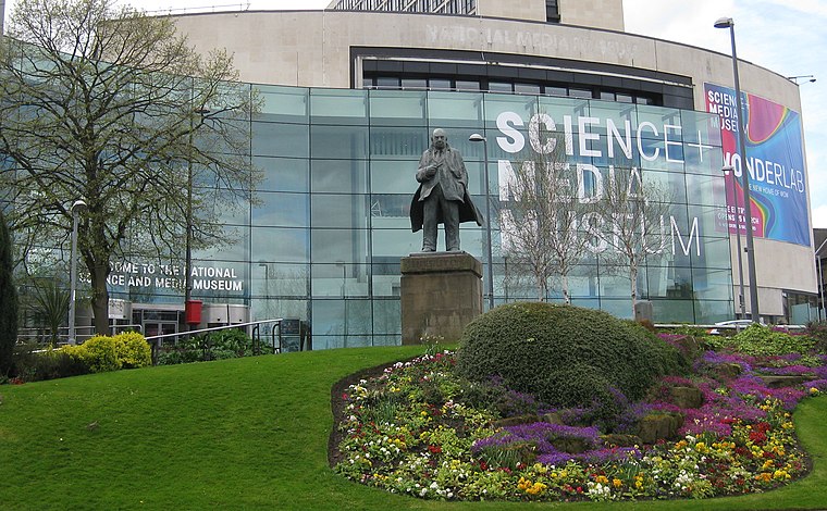
Photo: Chemical Engineer, CC BY-SA 4.0.
The National Science and Media Museum, located in Bradford, West Yorkshire, is part of the national Science Museum Group in the UK. The museum has seven floors of galleries with permanent exhibitions focusing on photography, television, animation, videogaming, the Internet and the scientific principles behind light and colour. National Science and Media Museum is situated 1,600 feet south of Tickles Music Hall.
Places in the Area
Nearby places include Little Germany and Barkerend.
Little Germany
Quarter
Little Germany is an area of particular historical and architectural interest in central Bradford, West Yorkshire, England. The architecture is predominantly neoclassical in style with an Italian influence.
Barkerend
Suburb

Photo: Betty Longbottom, CC BY-SA 2.0.
Barkerend is an inner-city area of Bradford, West Yorkshire, England, east of the city centre and surrounded by Undercliffe Cemetery, Bradford Moor, Laisterdyke, Bowling, Broomfields, Little Germany and Wapping, including an area of modern housing known as Pollard Park.
Broomfields
Neighborhood
Broomfields is a historic district on the south eastern edge of Bradford, West Yorkshire, England. In 1840 it was still a mainly rural area with a population of only a few hundred people.
Tickles Music Hall
- Type: Bar
- Address: 42-44 Westgate, Bradford, BD1 2QR
- Category: building
- Location: Bradford, England, United Kingdom, Britain and Ireland, Europe
- View on OpenStreetMap
Latitude
53.79504° or 53° 47′ 42″ northLongitude
-1.75651° or 1° 45′ 23″ westOpen location code
9C5WQ6WV+29OpenStreetMap ID
way 958617460OpenStreetMap feature
amenity=barOpenStreetMap feature
building=yes
This page is based on OpenStreetMap, Wikidata, and Wikimedia Commons.
We’d love your help improving our open data sources. Thank you for contributing.
Satellite Map
Discover Tickles Music Hall from above in high-definition satellite imagery.
Notable Places Nearby
Highlights include Kirkgate Shopping Centre and Bradford Mechanics Institute.
Nearby Places
Explore places such as Alastair Bateman and Smart Choice.
England: Must-Visit Destinations
Delve into London, Manchester, Sheffield, and Leeds.
Curious Bars to Discover
Uncover intriguing bars from every corner of the globe.
About Mapcarta. Data © OpenStreetMap contributors and available under the Open Database License". Text is available under the CC BY-SA 4.0 license, except for photos, directions, and the map. Photo: Inkey, CC BY 2.0.