Gymnázium Břeclav
Gymnázium Břeclav is a college in Břeclav, South Moravia. Gymnázium Břeclav is situated nearby to the church Chapel of St. Roch, as well as near the tourism office MobileGear.| Tap on a place to explore it |
Places of Interest Nearby
Highlights include Chapel of St. Roch and Břeclav railway station.

Břeclav railway station
Railway station
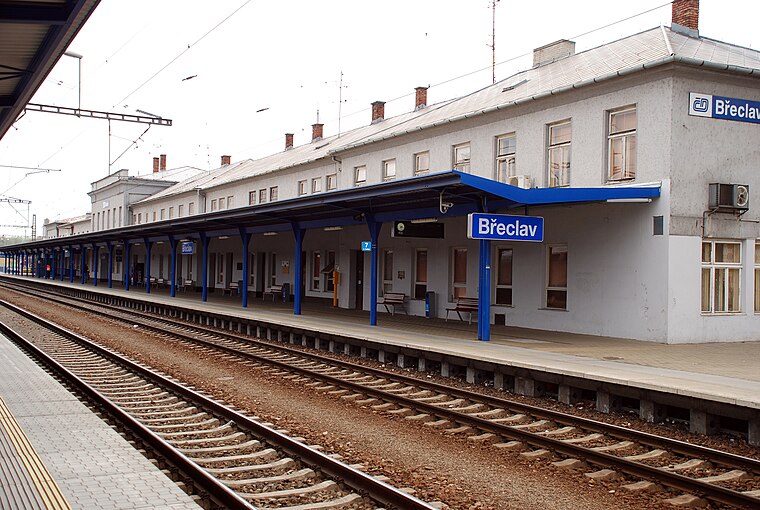
Photo: Josef Moser, CC BY-SA 3.0.
Břeclav railway station is an important international railway junction in the Czech Republic, located in the town of Břeclav in South Moravia, close to the borders with Austria and Slovakia. Břeclav railway station is situated 290 metres southeast of Gymnázium Břeclav.
Saint Cyril and Methodius Chapel
Church

Photo: VitVit, CC BY-SA 4.0.
Saint Cyril and Methodius Chapel is a church, which is situated 210 metres southeast of Gymnázium Břeclav.
Places in the Area
Nearby places include Břeclav and Charvátská Nová Ves.
Břeclav

Photo: Jana Červená, CC BY-SA 4.0.
Břeclav is a town in the South Moravian Region of the Czech Republic. It has about 25,000 inhabitants. Located at the Czech-Austrian state border and near the Czech–Slovak state border, it is an important railway hub.
Charvátská Nová Ves
Suburb

Photo: Herzi Pinki, CC BY-SA 3.0.
Charvátská Nová Ves is a suburb, which is situated 3½ km west of Gymnázium Břeclav.
Ladná
Village

Photo: Feťour, Public domain.
Ladná is a municipality and village in Břeclav District in the South Moravian Region of the Czech Republic. It has about 1,300 inhabitants. Ladná is situated 6 km north of Gymnázium Břeclav.
Gymnázium Břeclav
- Type: College
- Categories: building, public building, and education
- Location: Břeclav, Břeclav District, South Moravia, Czech Republic, Central Europe, Europe
- View on OpenStreetMap
Latitude
48.75578° or 48° 45′ 21″ northLongitude
16.89041° or 16° 53′ 26″ eastLevels
1Open location code
8FWRQV4R+85OpenStreetMap ID
way 96001648OpenStreetMap feature
amenity=collegeOpenStreetMap feature
building=civic
This page is based on OpenStreetMap, Wikidata, and Wikimedia Commons.
We’d love your help improving our open data sources. Thank you for contributing.
Satellite Map
Discover Gymnázium Břeclav from above in high-definition satellite imagery.
Notable Places Nearby
Highlights include MobileGear and BřecLove.
Nearby Places
Explore places such as Hlava and Dzing tea.
South Moravia: Must-Visit Destinations
Delve into Brno, Zlín, Znojmo, and Kroměříž.
Curious Places to Discover
Uncover intriguing places from every corner of the globe.
About Mapcarta. Data © OpenStreetMap contributors and available under the Open Database License". Text is available under the CC BY-SA 4.0 license, except for photos, directions, and the map. Photo: Marzper, CC BY-SA 3.0.