Salford Dental Practice
Salford Dental Practice is a dental clinic in Salford, England which is located on Liverpool Street. Salford Dental Practice is situated nearby to Horsham Street Community Garden, as well as near the community center Langworthy Cornerstone.| Tap on a place to explore it |
- Type: Dental clinic
- Address: 483 Liverpool Street, Salford
- Roof shape: gabled
Places of Interest Nearby
Highlights include St Luke’s Church, Pendleton and Salford Shopping Centre.
St Luke’s Church, Pendleton
Church

Photo: Plucas58, CC BY-SA 3.0.
St Luke's Church is an Anglican church that stands on raised ground in Liverpool Street, Pendleton, Salford. The church, in the parish of Weaste, Seedley and Langworthy, is part of the Salford All Saints Team Ministry in the Salford deanery and the Manchester diocese. St Luke’s Church, Pendleton is situated 1,300 feet west of Salford Dental Practice.
Salford Shopping Centre
Shopping center

Photo: Wikimedia, CC BY-SA 2.0.
Salford Shopping Centre is a shopping centre located in Salford, Greater Manchester, England. Built in 1972 in the Pendleton district of Salford, the shopping centre has been the subject of numerous redevelopment projects undertaken by Salford City Council. Salford Shopping Centre is situated 2,700 feet northeast of Salford Dental Practice.
Imperial War Museum North
Museum
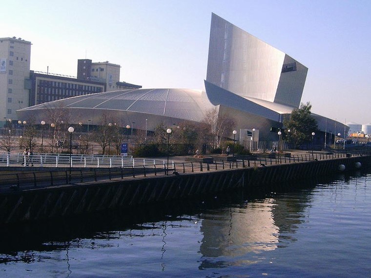
Photo: pit-yacker, CC BY-SA 2.0.
Imperial War Museum North is a museum in the Metropolitan Borough of Trafford in Greater Manchester, England. One of five branches of the Imperial War Museum, it explores the impact of modern conflicts on people and society. Imperial War Museum North is situated 1 mile south of Salford Dental Practice.
Places in the Area
Nearby places include Weaste and Seedley.
Weaste
Suburb
Weaste is an inner-city suburb of Salford, Greater Manchester, England. It is bordered by the town of Eccles to the West and Seedley to the East. In 2014 Weaste and Seedley ward had a population of 12,616.
Salford

Photo: Craig Sunter, CC BY 2.0.
Salford is a city in Greater Manchester in northwest England, with a population of 130,000 in 2021. It's separated from the City of Manchester by a loop of the River Irwell. Its biggest attraction is the Quays, but this area is described on a separate page.
Salford Dental Practice
- Categories: health care and building
- Location: Salford, England, United Kingdom, Britain and Ireland, Europe
- View on OpenStreetMap
Latitude
53.48379° or 53° 29′ 2″ northLongitude
-2.29677° or 2° 17′ 48″ westLevels
2Open location code
9C5VFPM3+G7OpenStreetMap ID
way 962063413OpenStreetMap feature
amenity=dentistOpenStreetMap feature
building=yesOpenStreetMap feature
healthcare=dentistOpenStreetMap attribute
roof-shape=gabled
This page is based on OpenStreetMap, Wikidata, and Wikimedia Commons.
We’d love your help improving our open data sources. Thank you for contributing.
Satellite Map
Discover Salford Dental Practice from above in high-definition satellite imagery.
Notable Places Nearby
Highlights include Horsham Street Community Garden and Langworthy Cornerstone.
Nearby Places
Explore places such as Stackd and Taj Curry.
England: Must-Visit Destinations
Delve into London, Manchester, Sheffield, and Leeds.
Curious Dental Clinics to Discover
Uncover intriguing dental clinics from every corner of the globe.
About Mapcarta. Data © OpenStreetMap contributors and available under the Open Database License". Text is available under the CC BY-SA 4.0 license, except for photos, directions, and the map. Photo: Craig Sunter, CC BY 2.0.