Heathrow Coach Centre
Heathrow Coach Centre is in Hillingdon, Greater London, England, and is located on Sipson Road. Heathrow Coach Centre is situated nearby to Cherry Lane Primary School, as well as near The King William IV Public House.| Tap on a place to explore it |
Places of Interest Nearby
Highlights include West Drayton railway station and The King William IV Public House.
West Drayton railway station
Railway station
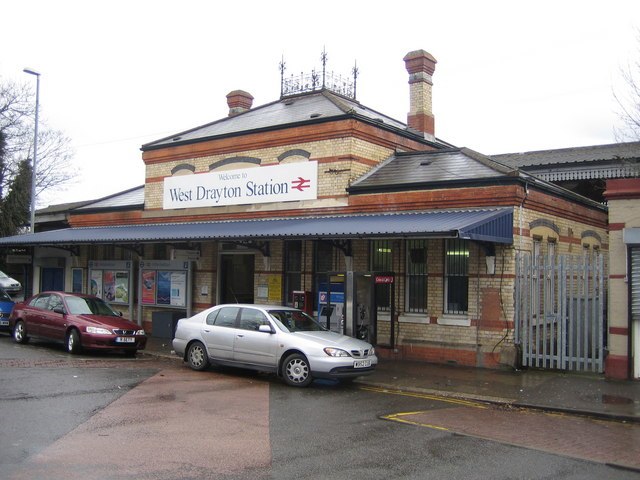
Photo: Nigel Cox, CC BY-SA 2.0.
West Drayton railway station serves West Drayton and Yiewsley, western suburbs of London. It is served and managed by the Elizabeth line. It is 13 miles 71 chains down the line from London Paddington and is situated between Hayes & Harlington to the east and Iver to the west. West Drayton railway station is situated 1¼ miles northwest of Heathrow Coach Centre.
The King William IV Public House
Pub
 The King William IV Public House is situated 1,800 feet south of Heathrow Coach Centre.
Harmondsworth Great Barn

Photo: Prioryman, CC BY-SA 3.0.
Harmondsworth Great Barn is a medieval barn on the former Manor Farm in the village of Harmondsworth, in the London Borough of Hillingdon, England. It is north-west of fields and the A4 next to Heathrow Airport. Harmondsworth Great Barn is situated 1 mile west of Heathrow Coach Centre.
Places in the Area
Nearby places include Sipson and West Drayton.
Sipson
Village
Sipson is a village in the London Borough of Hillingdon, the westernmost borough of Greater London, England. It is 14.3 miles west of Charing Cross and near the north perimeter of London Heathrow Airport.
West Drayton
Suburb

Photo: Rod Allday, CC BY-SA 2.0.
West Drayton is a suburban town in the London Borough of Hillingdon. It was an ancient parish in the county of Middlesex and from 1929 was part of the Yiewsley and West Drayton Urban District, which became part of Greater London in 1965.
Harmondsworth
Suburb

Photo: Ray Stanton, CC BY-SA 2.0.
Harmondsworth is a village in the London Borough of Hillingdon in the county of Greater London with a short border to the south onto London Heathrow Airport and close to the Berkshire county border.
Heathrow Coach Centre
- Type: Commerce
- Address: Sipson Road, Sipson, West Drayton, UB7 0HN
- Location: Hillingdon, Greater London, England, United Kingdom, Britain and Ireland, Europe
- View on OpenStreetMap
Latitude
51.49496° or 51° 29′ 42″ northLongitude
-0.45874° or 0° 27′ 31″ westOperator
National ExpressOpen location code
9C3XFGVR+XGOpenStreetMap ID
way 966759862OpenStreetMap feature
landuse=commercial
This page is based on OpenStreetMap, Wikidata, and Wikimedia Commons.
We’d love your help improving our open data sources. Thank you for contributing.
Satellite Map
Discover Heathrow Coach Centre from above in high-definition satellite imagery.
Notable Places Nearby
Highlights include Cherry Lane Primary School and Heathrow Primary School.
Nearby Places
Explore places such as Green Motion Car Rental London Heathrow Airport and The Plough.
England: Must-Visit Destinations
Delve into London, Manchester, Sheffield, and Leeds.
Curious Places to Discover
Uncover intriguing places from every corner of the globe.
About Mapcarta. Data © OpenStreetMap contributors and available under the Open Database License". Text is available under the CC BY-SA 4.0 license, except for photos, directions, and the map. Photo: sidibousaid, CC BY 2.0.