Edificio D
Edificio D is a public building in Valladolid, Castile and León. Edificio D is situated nearby to the government office Consejería de la Presidencia, as well as near the public building Edificio E.| Tap on a place to explore it |
Places of Interest Nearby
Highlights include Colegio de la Asunción, Valladolid and Iglesia de San Simón de Rojas.
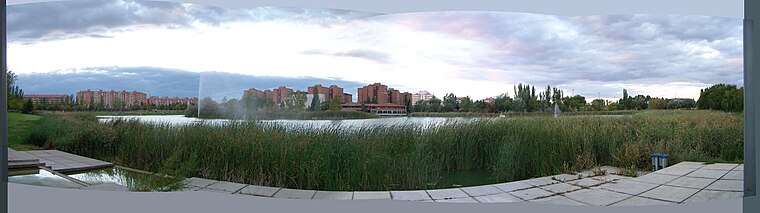
Colegio de la Asunción, Valladolid
Government office

Photo: Rodelar, CC BY-SA 4.0.
Colegio de la Asunción, Valladolid is a government office.
Iglesia de San Simón de Rojas
Church

Photo: Rodelar, CC BY-SA 3.0.
Iglesia de San Simón de Rojas is a church, which is situated 500 metres northwest of Edificio D.
Centro Cívico José María Luelmo
Community center

Photo: Wikimedia, CC BY-SA 3.0.
Centro Cívico José María Luelmo is a community center, which is situated 1¼ km north of Edificio D.
Places in the Area
Nearby places include Arroyo de la Encomienda and Laguna de Duero.
Arroyo de la Encomienda
Town
 Arroyo de la Encomienda is a municipality located in the province of Valladolid, Castile and León, Spain. According to the 2015 census, the municipality has a population of 18491 inhabitants. Arroyo de la Encomienda is situated 3 km northwest of Edificio D.
Laguna de Duero
Town
 Laguna de Duero is a municipality located in the province of Valladolid, Castile and León, Spain. According to the 2016 census, the municipality has a population of 22,696 inhabitants. Laguna de Duero is situated 4 km southeast of Edificio D.
La Circular
Suburb

Photo: Rodelar, CC BY-SA 3.0.
La Circular is a suburb, which is situated 5 km northeast of Edificio D.
Edificio D
- Type: Public building
- Categories: building and government building
- Location: Valladolid, Valladolid, Castile and León, Central Spain, Spain, Iberia, Europe
- View on OpenStreetMap
Latitude
41.60991° or 41° 36′ 36″ northLongitude
-4.7487° or 4° 44′ 55″ westOpen location code
8CHQJ752+XGOpenStreetMap ID
way 968151462OpenStreetMap feature
building=public
This page is based on OpenStreetMap, Wikidata, and Wikimedia Commons.
We’d love your help improving our open data sources. Thank you for contributing.
Satellite Map
Discover Edificio D from above in high-definition satellite imagery.
Places with the Same Name
Discover other places named “Edificio D”.
Notable Places Nearby
Highlights include Consejería de la Presidencia and Edificio E.
Nearby Places
Explore places such as Silmarill and Calle Santiago Alba.
Castile and León: Must-Visit Destinations
Delve into Salamanca, Segovia, León, and Burgos.
Curious Public Buildings to Discover
Uncover intriguing public buildings from every corner of the globe.
About Mapcarta. Data © OpenStreetMap contributors and available under the Open Database License". Text is available under the CC BY-SA 4.0 license, except for photos, directions, and the map. Photo: Wikimedia, CC BY 2.5.