Les Culs de Caravailles
Les Culs de Caravailles is a residential area in Six-Fours-les-Plages, Arrondissement of Toulon, Provence-Alpes-Côte d’Azur. Les Culs de Caravailles is situated nearby to Poney’s Ranch, as well as near the cemetery Cimetière de Courrens.| Tap on a place to explore it |
Places of Interest Nearby
Highlights include Batterie de Peyras and Embiez.
Batterie de Peyras
Museum

Photo: Technob105, CC BY-SA 3.0.
Batterie de Peyras is a museum, which is situated 3 km southeast of Les Culs de Caravailles.
Embiez
Island

Photo: Wikimedia, CC BY-SA 3.0.
The Île des Embiez is a French island in the Mediterranean Sea. It is the largest island in the Embiez archipelago. It is located off the coast of the port of Le Brusc in the commune of Six-Fours-les-Plages, in the Var department in the Provence-Alpes-Côte d'Azur region in South Eastern France. Embiez is situated 4 km west of Les Culs de Caravailles.
Collégiale Saint-Pierre de Six-Fours
Church
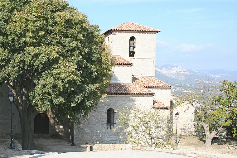
Photo: Rvalette, CC BY-SA 3.0.
Collégiale Saint-Pierre de Six-Fours is a church, which is situated 3 km north of Les Culs de Caravailles.
Places in the Area
Nearby places include Six-Fours-les-Plages and La Seyne-sur-Mer.
Six-Fours-les-Plages
Town

Photo: Flobio83, CC BY-SA 3.0.
Six-Fours-les-Plages is a commune in the Var department in the Provence-Alpes-Côte d'Azur region in southeastern France. Inhabitants of Six-Fours-les-Plages refer to themselves as "Six-Fournais".
La Seyne-sur-Mer
Town

Photo: Mfe, CC BY-SA 3.0.
La Seyne-sur-Mer, or simply La Seyne, is a commune in the Var department in the Provence-Alpes-Côte d'Azur region in Southeastern France. La Seyne-sur-Mer, which is part of the agglomeration of Toulon, is situated adjacent to the west of the city. La Seyne-sur-Mer is situated 4½ km northeast of Les Culs de Caravailles.
Sanary-sur-Mer

Photo: Marianne Casamance, CC BY-SA 3.0.
Sanary-sur-Mer, popularly known as Sanary, is a commune in the Var department in the Provence-Alpes-Côte d'Azur region, Southeastern France. Sanary-sur-Mer is located in coastal Provence on the Mediterranean Sea, 13 km west of Toulon and 49 km southeast of Marseille.
Les Culs de Caravailles
Latitude
43.07887° or 43° 4′ 44″ northLongitude
5.83361° or 5° 50′ 1″ eastOpen location code
8FM73RHM+GCOpenStreetMap ID
way 973561877OpenStreetMap feature
landuse=residential
This page is based on OpenStreetMap, Wikidata, and Wikimedia Commons.
We’d love your help improving our open data sources. Thank you for contributing.
Satellite Map
Discover Les Culs de Caravailles from above in high-definition satellite imagery.
Notable Places Nearby
Highlights include Poney’s Ranch and Cimetière de Courrens.
Nearby Places
Explore places such as Centre aéré jaumard and Le Pilat.
Var: Must-Visit Destinations
Delve into Toulon, Saint-Tropez, Hyères, and Fréjus.
Curious Residential Areas to Discover
Uncover intriguing residential areas from every corner of the globe.
About Mapcarta. Data © OpenStreetMap contributors and available under the Open Database License". Text is available under the CC BY-SA 4.0 license, except for photos, directions, and the map. Photo: Tobi 87, CC BY-SA 3.0.