TrifelsFitness
TrifelsFitness is a sports venue in Annweiler am Trifels, Südliche Weinstraße, Rhineland-Palatinate. TrifelsFitness is situated nearby to the cave Karin Stollen, as well as near Jewish cemetery, Annweiler am Trifels.| Tap on a place to explore it |
Places of Interest Nearby
Highlights include Jewish cemetery, Annweiler am Trifels and Trifels Castle.
Jewish cemetery, Annweiler am Trifels
Cemetery

Photo: RuWild, CC BY-SA 4.0.
Jewish cemetery, Annweiler am Trifels is situated 370 metres northeast of TrifelsFitness.
Trifels Castle

Photo: Carsten Steger, CC BY-SA 4.0.
Trifels Castle is a reconstructed medieval castle at an elevation of 500 m near the small town of Annweiler, in the Palatinate region of southwestern Germany. Trifels Castle is situated 1¼ km south of TrifelsFitness.
Annweiler am Trifels station
Railway station

Photo: Wikimedia, CC BY-SA 3.0.
Annweiler am Trifels station is the main station in the town of Annweiler am Trifels in the German state of Rhineland-Palatinate. Deutsche Bahn classifies it as a category 5 station and it has three platform tracks. Annweiler am Trifels station is situated 1 km west of TrifelsFitness.
Places in the Area
Nearby places include Queichhambach and Bindersbach.


Vogelstockerhof
Hamlet
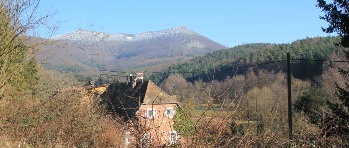
Photo: Vogelstockerhof, CC BY-SA 4.0.
Vogelstockerhof is a hamlet, which is situated 3 km northeast of TrifelsFitness.
TrifelsFitness
- Type: Sports venue
- Categories: building, recreation area, and sports location
- Location: Annweiler am Trifels, Südliche Weinstraße, Rhineland-Palatinate, Germany, Central Europe, Europe
- View on OpenStreetMap
Latitude
49.207° or 49° 12′ 25″ northLongitude
7.97792° or 7° 58′ 41″ eastOpen location code
8FX96X4H+Q5OpenStreetMap ID
way 98180904OpenStreetMap feature
building=yesOpenStreetMap feature
leisure=sports_centreOpenStreetMap feature
sport=multi
This page is based on OpenStreetMap, Wikidata, and Wikimedia Commons.
We’d love your help improving our open data sources. Thank you for contributing.
Satellite Map
Discover TrifelsFitness from above in high-definition satellite imagery.
Notable Places Nearby
Highlights include Karin Stollen and Trifelsstadion.
Nearby Places
Explore places such as Annweiler, Arbeiterheim and Annweiler, Arbeiterheim.
Rhineland-Palatinate: Must-Visit Destinations
Delve into Mainz, Trier, Koblenz, and Worms.
Curious Sports Venues to Discover
Uncover intriguing sports venues from every corner of the globe.
About Mapcarta. Data © OpenStreetMap contributors and available under the Open Database License". Text is available under the CC BY-SA 4.0 license, except for photos, directions, and the map. Photo: Traveler100, CC BY-SA 3.0.