Yarrawonga-Mulwala
Yarrawonga-Mulwala is a twin city on the border of the Murray River in the Riverina.| Tap on a place to explore it |
Photo: Mattinbgn, Public domain.
Places of Interest
Highlights include Yarrawonga Weir Power Station and Yarrawonga Airport.
Yarrawonga Weir Power Station
Power station
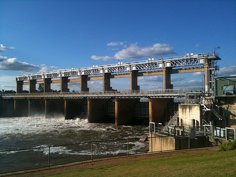
Photo: Mattinbgn, CC BY-SA 3.0.
Yarrawonga Weir Power Station is a hydroelectric power station at Lake Mulwala on the Murray River, Victoria, Australia. Yarrawonga Weir has a generating capacity of 9.5 megawatts of electricity.
Yarrawonga Airport
Aerodrome
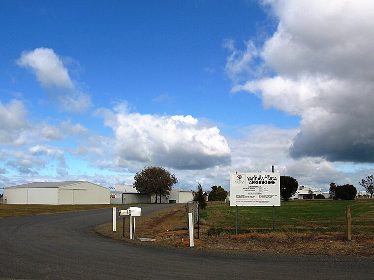
Photo: Mattinbgn, CC BY-SA 3.0.
Yarrawonga Airport is located 2 nautical miles south-east of the town of Yarrawonga, Victoria on the border with New South Wales, Australia.
Places in the Area
Nearby places include Yarrawonga.
Yarrawonga
Town
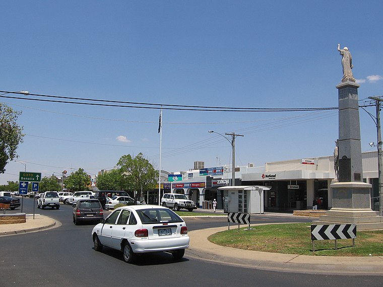
Photo: Mattinbgn, Public domain.
Yarrawonga is a town in the Shire of Moira local government area in the Australian state of Victoria. In the 2021 census, Yarrawonga had a population of 8,661 people.
Yarrawonga-Mulwala
- Type: city
- Location: The Murray, Victoria, Australia, Oceania
- View on OpenStreetMap
Latitude
-36.005° or 36° 0′ 18″ southLongitude
146.005° or 146° 0′ 18″ eastOpen location code
4RM8X2V3+XXWikidata ID
Q14928192
This page is based on Wikidata, Wikimedia Commons, and Wikivoyage.
We’d love your help improving our open data sources. Thank you for contributing.
Satellite Map
Discover Yarrawonga-Mulwala from above in high-definition satellite imagery.
Localities in the Area
Explore places such as Ram’s Head and Rifle Butts.
The Murray: Must-Visit Destinations
Delve into Mildura, Shepparton, Swan Hill, and Euroa.
Explore These Curated Destinations
Discover places selected for their distinct character and enduring appeal.
About Mapcarta. Text is available under the CC BY-SA 4.0 license, except for photos, directions, and the map. Description text is based on the Wikivoyage page “Yarrawonga-Mulwala”. Photo: Mattinbgn, Public domain.