Giv`at Rabbi
Giv`at Rabbi is a peak in Northern District, Israel and has an elevation of 291 metres. Giv`at Rabbi is situated nearby to the village Zippori, as well as near Ilut.| Tap on a place to explore it |
Places of Interest
Highlights include Nabi Saeen Mosque and Salesian Church - Don Bosco.
Nabi Saeen Mosque
Mosque

Photo: Zairon, CC BY-SA 4.0.
The Nabi Saeen Mosque is a mosque located on Nabi Saeen Hill in Nazareth, in northern Israel. The mosque is located at the top of the ridge enclosing the city from the north, approximately 150 metres north of the Salesian Basilica of Jesus the Adolescent, providing a panoramic view of Nazareth and the Jezreel Valley to the south, and the Upper Galilee and Haifa outskirts to the north and west.
Salesian Church - Don Bosco
Church

Photo: Almog, Public domain.
The Basilica of Jesus the Adolescent, also known as the Salesian church is a Catholic church in Nazareth in Israel, belonging to the Salesians of Don Bosco.
Places in the Area
Nearby places include Zippori and Zippori.
Zippori
Village

Photo: Almog, Public domain.
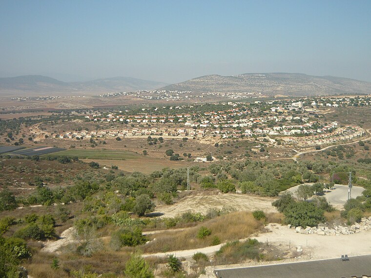
Tzippori is a moshav in northern Israel, in the Lower Galilee. The moshav is within the jurisdiction of the Jezreel Valley Regional Council. The moshav was founded 3 km southeast of the ancient settlement of Sepphoris, after which it was named.
Zippori

Photo: Wikimedia, CC BY-SA 3.0.
Zippori is an archaeological site and national park in the Lower Galilee region of Israel, near Nazareth.
Ilut
Village

Photo: Dtalpk, CC BY-SA 4.0.
Ilut, also spelt ʿAilut, is an Arab local council in the Northern District of Israel. It was declared a local council in 1991. In 2023 its population was 8,894.
Giv`at Rabbi
- Type: Peak with an elevation of 291 metres
- Description: hill in Northern District, Israel
- Categories: hill and landform
- Location: Northern District, Israel, Middle East, Asia
- View on OpenStreetMap
Latitude
32.73472° or 32° 44′ 5″ northLongitude
35.26944° or 35° 16′ 10″ eastElevation
291 metres (955 feet)Open location code
8G4QP7M9+VQOpenStreetMap ID
node 278476650OpenStreetMap feature
natural=peak
This page is based on OpenStreetMap, GeoNames, Wikidata, and Wikimedia Commons.
We’d love your help improving our open data sources. Thank you for contributing.
Satellite Map
Discover Giv`at Rabbi from above in high-definition satellite imagery.
In Other Languages
From Cebuano to Swedish—“Giv`at Rabbi” goes by many names.
- Cebuano: “Giv‘at Rabbi”
- Dutch: “Giv‘at Rabbi”
- Hebrew: “Giv‘at Rabbi”
- Hebrew: “גבעת רבי”
- Swedish: “Giv‘at Rabbi”
Localities in the Area
Explore places such as Shimshit and Ilut.
Notable Places Nearby
Highlights include Ein Zippori and מרכז שדה ויער ציפורי.
Israel: Must-Visit Destinations
Delve into Tel Aviv, Carmel Range, Haifa, and Nazareth.
Curious Places to Discover
Uncover intriguing places from every corner of the globe.
About Mapcarta. Data © OpenStreetMap contributors and available under the Open Database License". Text is available under the CC BY-SA 4.0 license, except for photos, directions, and the map. Photo: Bienchido, CC BY-SA 3.0.