Tembroek
Tembroek is a farm in Pajottegem, Arrondissement Halle-Vilvoorde, Flanders. Tembroek is situated nearby to the locality Terlinden, as well as near Nattendries.| Tap on a place to explore it |
Places of Interest
Highlights include Enghien railway station and St. Peter and Paul’s Church.
Enghien railway station
Railway station
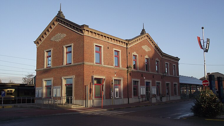
Photo: Smiley.toerist, CC BY-SA 3.0.
Enghien railway station is situated 3½ km southwest of Tembroek.
St. Peter and Paul’s Church
Church

Photo: Yosephus, CC BY-SA 2.5.
St. Peter and Paul’s Church is situated 3 km west of Tembroek.
Sint-Niklaaskerk (Herfelingen)
Church
 Sint-Niklaaskerk (Herfelingen) is a church, which is situated 3 km northeast of Tembroek.
Places in the Area
Nearby places include Herne and Herfelingen.
Herne
Village

Photo: Yosephus, CC BY-SA 2.5.
Herne is a former municipality in the province of Flemish Brabant, in Flanders, one of the three regions of Belgium. It now in the municipality of Pajottegem, following the 2025 fusion of the Belgian municipalities. Herne is situated 3 km west of Tembroek.
Herfelingen
Village

Photo: David Edgar, CC BY-SA 3.0.
Herfelingen is a village in the municipality of Herne in the Belgian province of Flemish Brabant. It was a municipality itself until the fusion of the municipalities in 1977. Herfelingen is situated 3 km northeast of Tembroek.
Heikruis
Village

Photo: Funkyxian, CC BY-SA 3.0.
Heikruis is a village, which is situated 3½ km east of Tembroek.
Tembroek
- Type: Farm
- Category: agriculture
- Location: Pajottegem, Arrondissement Halle-Vilvoorde, Flemish Brabant, Flanders, Belgium, Benelux, Europe
- View on OpenStreetMap
Latitude
50.72573° or 50° 43′ 33″ northLongitude
4.06874° or 4° 4′ 8″ eastElevation
69 metres (226 feet)Open location code
9F26P3G9+7FGeoNames ID
2785791
This page is based on GeoNames, Wikidata, and Wikimedia Commons.
We’d love your help improving our open data sources. Thank you for contributing.
Satellite Map
Discover Tembroek from above in high-definition satellite imagery.
Localities in the Area
Explore places such as Terlinden and Tembroek.
Notable Places Nearby
Highlights include Bois de Strihoux and Bois de Ham.
Flemish Brabant: Must-Visit Destinations
Delve into Leuven, Kraainem, Vilvoorde, and Aarschot.
Curious Places to Discover
Uncover intriguing places from every corner of the globe.
About Mapcarta. Text is available under the CC BY-SA 4.0 license, except for photos, directions, and the map. Photo: Gf uip, CC BY-SA 3.0.