116 Hotel
116 Hotel is a hotel in Suba, Bogotá D.C., Bogotá and has an elevation of 2,435 metres. 116 Hotel is situated nearby to the school Colegio Agustiniano Norte, as well as near the neighborhood La Castellana.| Tap on a place to explore it |
Places of Interest Nearby
Highlights include Colegio Agustiniano Norte and Bogotá Colombia Temple.
Colegio Agustiniano Norte
School
Colegio Agustiniano Norte is a private Catholic primary and secondary school, located in Bogotá, Colombia. Founded in 1969 as a school for boys only, the school is now co-educational, teaching students from kindergarten to grade 11. Colegio Agustiniano Norte is situated 240 metres west of 116 Hotel.
Bogotá Colombia Temple
Church
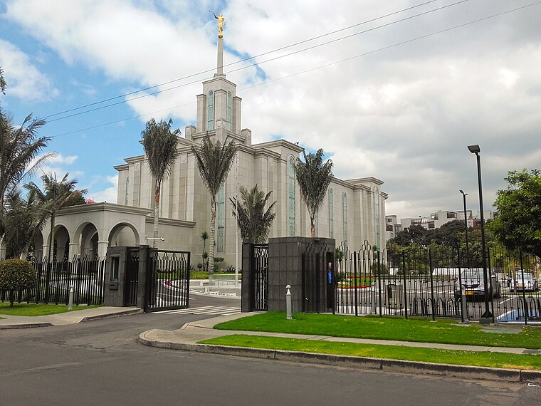
Photo: EEIM, CC BY-SA 4.0.
The Bogotá Colombia Temple is a temple of the Church of Jesus Christ of Latter-day Saints, located in Bogotá, Colombia. The intent to construct the temple was announced on April 7, 1984, by Gordon B. Bogotá Colombia Temple is situated 1½ km northeast of 116 Hotel.
Ferias
Bus station

Photo: Pedro Felipe, CC BY-SA 4.0.
The simple station Ferias is part of the TransMilenio mass-transit system of Bogotá, Colombia, opened in the year 2000. Ferias is situated 2 km southwest of 116 Hotel.
Places in the Area
Nearby places include La Castellana and Northwest Bogotá.

Northwest Bogotá

Photo: Pedro Felipe, CC BY-SA 3.0.
Northwest Bogotá is comprised majorly by the locality of Suba, and a small part of the locality of Barrios Unidos. The locality of Suba is the most populous district in Bogota, with over 1 and a half million citizens, it is almost its own independent city.
Usaquén

Photo: Pedro Felipe, CC BY-SA 3.0.
Usaquén is one of the largest districts in Bogota with nearly 1 million citizens. Usaquen is where many of the wealthiest and most affluent neighborhoods in the city are located, being the seat to huge high-end shopping malls, luxury boutiques, vast financial…
116 Hotel
- Type: Hotel
- Categories: accommodation, building, and tourism
- Location: Suba, Bogotá D.C., Bogotá, Andino, Colombia, South America
- View on OpenStreetMap
Latitude
4.70045° or 4° 42′ 2″ northLongitude
-74.06934° or 74° 4′ 10″ westElevation
2,435 metres (7,989 feet)Open location code
67P7PW2J+57GeoNames ID
9612550
This page is based on GeoNames, Wikidata, and Wikimedia Commons.
We’d love your help improving our open data sources. Thank you for contributing.
Satellite Map
Discover 116 Hotel from above in high-definition satellite imagery.
Localities in the Area
Explore places such as Morato and Puente Largo.
Nearby Places
Explore places such as Casa Hotel Zuetana 119 and Hotel Suites Chico.
Bogotá: Must-Visit Destinations
Delve into La Candelaria, Zona Rosa, Santa Fé-Los Mártires, and Usaquén.
Curious Places to Discover
Uncover intriguing places from every corner of the globe.
About Mapcarta. Text is available under the CC BY-SA 4.0 license, except for photos, directions, and the map. Photo: Wikimedia, CC BY-SA 3.0.