Quebrada El Llano
Quebrada El Llano is a stream in Huila, Andino and has an elevation of 912 metres. Quebrada El Llano is situated nearby to the locality Vega Seca, as well as near Vereda San Lorenzo.| Tap on a place to explore it |
Places in the Area
Nearby places include Colombia.
Colombia
Town
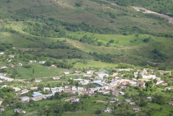
Photo: Edith milena garcia mora, CC BY-SA 4.0.
Colombia is a town and municipality in the Huila Department, Colombia. Colombia is situated 6 km southeast of Quebrada El Llano.
Quebrada El Llano
- Type: Stream
- Category: body of water
- Location: Huila, Andino, Colombia, South America
- View on OpenStreetMap
Latitude
3.40935° or 3° 24′ 34″ northLongitude
-74.83863° or 74° 50′ 19″ westElevation
912 metres (2,992 feet)Open location code
67M7C556+PGGeoNames ID
10321568
This page is based on GeoNames, Wikidata, and Wikimedia Commons.
We’d love your help improving our open data sources. Thank you for contributing.
Satellite Map
Discover Quebrada El Llano from above in high-definition satellite imagery.
In Other Languages
“Quebrada El Llano” goes by many names.
- Spanish: “Quebrada El Llano”
Places with the Same Name
Discover other places named “Quebrada El Llano”.
Localities in the Area
Explore places such as Vega Seca and Vereda San Lorenzo.
Notable Places Nearby
Highlights include Filo de San Pedro and Loma El Banquito.
Huila: Must-Visit Destinations
Delve into Neiva, Nevado del Huila National Natural Park, San Agustin, and Villavieja.
Curious Streams to Discover
Uncover intriguing streams from every corner of the globe.
About Mapcarta. Text is available under the CC BY-SA 4.0 license, except for photos, directions, and the map. Photo: Wikimedia, CC0.