Tysk antiubådsmine
Tysk antiubådsmine is in Hjørring, North Jutland. Tysk antiubådsmine is situated nearby to Bunkermuseum, as well as near the lighthouse Hirtshals Light.| Tap on a place to explore it |
Places of Interest Nearby
Highlights include Hirtshals Light and Hirtshals railway station.

Hirtshals railway station
Railway station
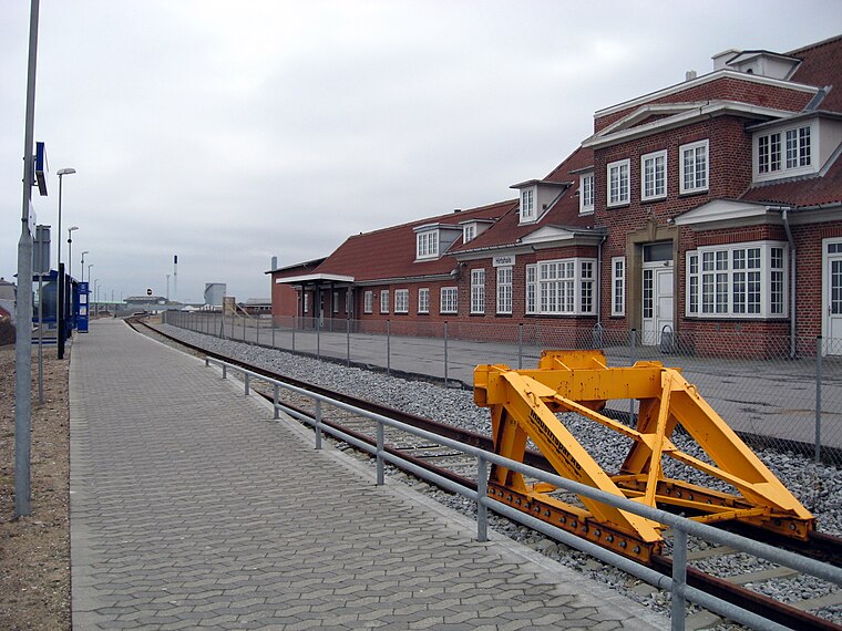 Hirtshals railway station is the main railway station serving the town of Hirtshals in Vendsyssel, Denmark. The station is the northern terminus of the Hirtshalsbanen railway line from Hjørring to Hirtshals. Hirtshals railway station is situated 1½ km northeast of Tysk antiubådsmine.
Hirtshals Church
Church

Photo: Matthias Schalk, CC BY-SA 3.0.
Hirtshals Church is situated 1¼ km east of Tysk antiubådsmine.
Places in the Area
Nearby places include Hirtshals and Horne.
Hirtshals

Photo: DXR, CC BY-SA 4.0.
Hirtshals is a town and seaport on the coast of Skagerrak on the island of Vendsyssel-Thy at the top of the Jutland peninsula in northern Denmark, Europe.
Horne
Village

Photo: Dphreak, CC BY-SA 2.5.
Horne is a village in Hjørring Municipality in North Jutland Region, Denmark. As of 1 January 2025, it has the population of 661. It is located in the north-western part of the Vendsyssel district about 5 km south of the town of Hirtshals. Horne is situated 4 km southeast of Tysk antiubådsmine.

Tysk antiubådsmine
- Type: Sign
- Categories: information and tourism
- Location: Hjørring, North Jutland, Jutland, Denmark, Nordic countries, Europe
- View on OpenStreetMap
Latitude
57.58497° or 57° 35′ 6″ northLongitude
9.94304° or 9° 56′ 35″ eastOpen location code
9F9FHWMV+X6OpenStreetMap ID
node 10677027608OpenStreetMap feature
tourism=information
This page is based on OpenStreetMap, Wikidata, and Wikimedia Commons.
We’d love your help improving our open data sources. Thank you for contributing.
Satellite Map
Discover Tysk antiubådsmine from above in high-definition satellite imagery.
Notable Places Nearby
Highlights include Bunkermuseum and Stensamling.
Nearby Places
Explore places such as Bunkermuseet Hirtshals 10. Batteri and Mandskabsbunker.
North Jutland: Must-Visit Destinations
Delve into Aalborg, Frederikshavn, Skagen, and Læsø.
Curious Places to Discover
Uncover intriguing places from every corner of the globe.
About Mapcarta. Data © OpenStreetMap contributors and available under the Open Database License". Text is available under the CC BY-SA 4.0 license, except for photos, directions, and the map. Photo: Tsca, CC BY 3.0.